On leaving Fairbanks, we gave some consideration to traveling north up the Dalton Highway towards the Arctic Circle or even as far as the Arctic Ocean but it came down to making a choice between either of those and having to cut out a day or even two to somewhere else as we had reservations on the weekly ferry ride from Haines in about a week. The side trip just wasn’t worth it so we headed to our next planned destination, Denali National Park.
Denali National Park and Preserve dates back to 1917 when Congress approved the creation of McKinley National Park. While its most famous feature is the tallest mountain in the US, the park and preserve includes 6 million acres of wild country with a single ribbon of road through it. But first we have to get there!
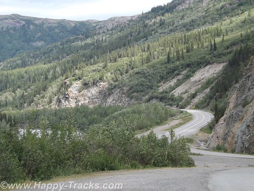
The ride from Fairbanks to Denali started out alternating between relatively flat with mountains in the distance or else riding along higher up with the scenery falling away to either side of the road. We crossed over the Nenana River where there was an old tug boat pulled up along the shore which had pulled freight up and down the river.
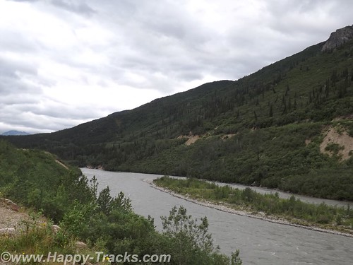
Eventually the road begins the dip into a canyon following the course of the Nenana Creek. We encountered more construction both for roads and bridges. The road construction had a pilot car for a length of unpaved road but the short bridges were controlled by a flagman or a portable traffic light.
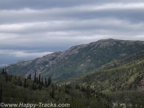
The skies were partly cloudy which resulted in light patterns on the landscape for additional texture.
Just before we got to the road into Denali, there was a village of hotels, cabins, resorts, stores, and outfitters catering to the tourist trade. They all looked to be doing a good business this day.
Charles Sheldon, a gentleman hunter from Vermont and others lobbied Congress for nearly a decade before persuading them to create Mt. McKinley National Park in 1917. In 1921, Harry Karstens, an outdoorsman and dog musher was hired as the first park superintendent. Gold miners and others in Fairbanks and nearby called the icy granite mountain Mt. McKinley. Sheldon referred to it as “the mountain” or Denali, the Athabascan name meaning the high one. Mt. McKinley is now officially 20,237 feet above sea level, the highest in North America. This figure is 83 feet shorter than the 1952 number (which would have been when my folks were in the area.) There is this interesting article on Discovery.com which talks about why the differences.
Along with the wild landscape there were also animals in the area that were to be protected. Specifically, the Dall sheep in the area were being aggressively killed by market hunters. Per the stories we were told there, the market hunters would kill the sheep they needed to market and would also kill the other sheep around and leave them to rot to limit their competitors ability to provide meat. The National Park and Preserve designation was a small step in providing some control over that situation.
Arriving at the park entrance, the roadway goes to the campgrounds and also to the visitors center. From the visitors center, there are options for interior transportation. There are guided tour buses which travel into the interior of the park and various shuttles to different points within the park.
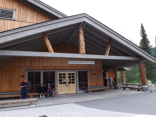
We went directly to the visitors center. This is the spot to get acclimated and find out about the various accommodations for getting around. The visitors center also has a small cafeteria and a gift shop. The 85 mile road through the park has access limited to the tour buses and the campers’ shuttles. There are also flight-seeing tours from nearby Talkeetna that take you around, some even land to let you walk around.
We chose to take the short shuttle to the Sled Dog Kennels. The dogs are working animals at the park providing access to remote areas and support for working and research parties even during the winter months. More about the kennels here.
The bus (similar to school buses) takes you on the 10 minute ride (or it could be except for the stops for road construction) to the kennels. During the summer months, rangers and the dogs demonstrate a working team. Before the demonstrations in the summer, you get a chance to visit with and pet the dogs. Visits and petting are opportunities year round but the demonstrations are summer months only.
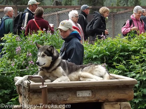
We were surprised to learn that the dogs are controlled by voice command only. For some reason, we had always thought there were reins or similar like larger draft animals.
Each position in the dog team has a specific purpose and different dogs are better suited for each position. Nearest the sled is the wheel dog. The wheel dogs are the strongest and provide momentum to get the sled up on the surface and moving (like getting a boat up on plane).
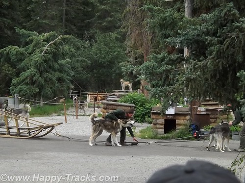
In front of the wheel dog is the swing dog. The swing dog provides power but is also trained to swing out on a turn, rather than follow directly in the tracks of the lead dog. The lead dog responds to voice control to turn, go or stop. The dog team may include up to 12 dogs depending on the load and course to be run.
The dogs typically have a 9 year life on the sleds with an average 14 year life span. That link above even talks about adopting retired dogs.
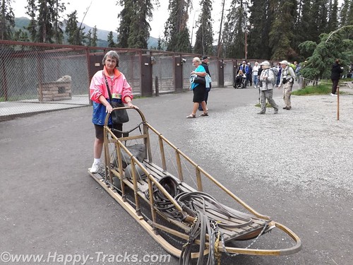
As an aside, we saw the tourist couple we met at LARS in Fairbanks and said hello.
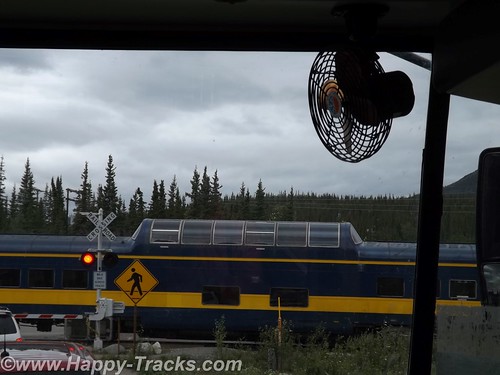
We rode back to the visitors center and decided to take one of the shuttle buses for a brief ride around to the campgrounds. It became more clear that many of the tourists in the park are camping or hiking parts of the large park. While on the shuttle, we stopped at the train crossing to let the Alaska Railroad Denali route train go by. Many tourists will board the train for the ride between Anchorage and Denali with a stop in Talkeetna for more of the beautiful scenery.
We didn’t really appreciate just how big the park and preserve are. We were unable to see Mt. McKinley from the visitors’ center. We were actually surprised that we asked several of the non-NPS workers which direction the Mountain was and they didn’t know. We’ve since learned Mt. McKinley is about 80 miles southwest from the visitors’ center.
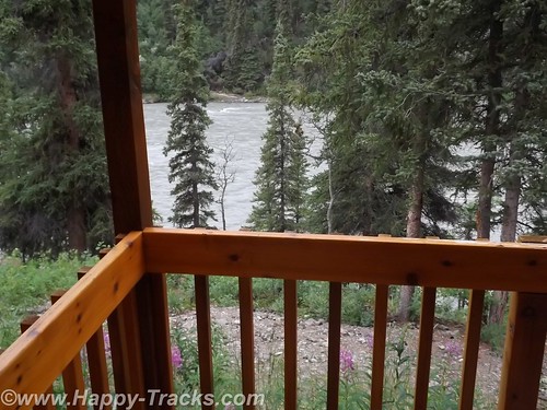
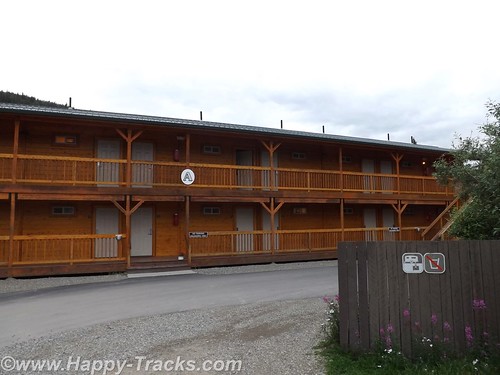
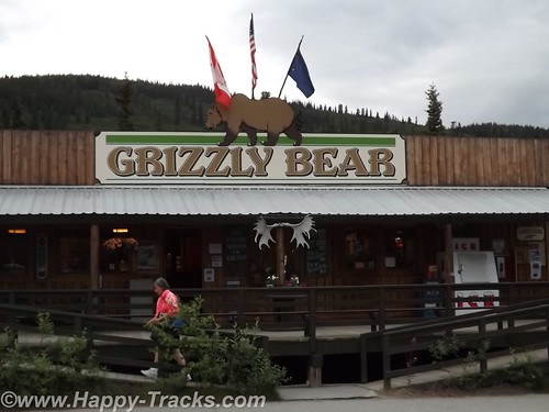
After several hours at the park, we headed out for our accommodations which had been recommended by a fellow on ExpeditionPortal forums. Healy Denali Grizzly Bear Cedar Lodge is just a few miles south of the park entrance (although our GPS directions sent us north instead). The Grizzly Bear Cedar Lodge is away from the cluster of hotels in the village outside the gate and has RV sites, a small general store, a laundromat and a gift shop. The Cedar Lodge itself is set on the banks of the Nenana River. Its not as expensive as the village but doesn’t have all the shops and entertainment within walking distance.
We did get a recommendation for the restaurant just a bit further south, 229 Parks. The food was a more local produce with many non-fried food choices. We had the salmon and the crabcakes and would recommend both the restaurant and lodge to visitors to the area provided you have transportation with you.
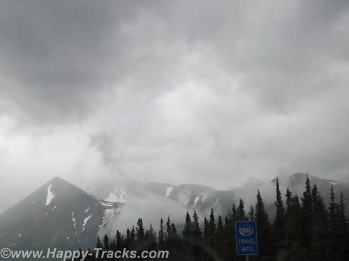
The next morning, we headed south towards Anchorage. We still hadn’t seen Mt. McKinley but there were supposed to be several points along the road where we could see it, weather permitting. As we drove along, we saw fog and clouds where Mt. McKinley should be but we never saw the place where we could get out weather permits and thus left Alaska without seeing the Mountain.
You can see all of the pictures and 2 more short videos from this leg of the trip here.
We invite you to continue along with us and hope you enjoy the account!
Tag Archives: Fairbanks
Summer 2014: Alaska via the AlCan, Fairbanks
Continuing north from Delta Junction toward Fairbanks, we crossed the Tanana River and got our first glimpse of the Alaskan Oil Pipeline where it crossed the river near the road.
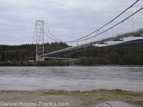
The pipeline is 48 inches in diameter, 800 miles long and crosses three mountain ranges and over 500 rivers and streams.
Most of the major river crossings for the pipeline have the pipeline buried under the river bottom but the power of the current and the silt here create major scouring of the river bottom. The scouring could eventually expose the buried pipeline and lead to damage. The pipeline is built to withstand an earthquake up to 7.5 and cold down to 60 below. The pipeline includes zigzags in its course to allow for some shock absorption as well as thermal expansion. The supports are built to transfer heat away and thus prevent melting of the frozen ground beneath the towers.
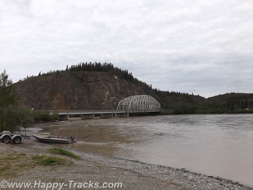
The bridge over the Tanana is the second longest along the pipeline at 1200 feet. This crossing over the Tanana River is the first place you see the pipeline in the ride up the AlCan towards Fairbanks.
Special consideration was given to the wildlife along the pipeline’s course to minimize the impact of the pipeline. Those considerations include the tower designs as well as lengths where the pipeline remains below ground to allow for uninterrupted crossings by the wildlife.
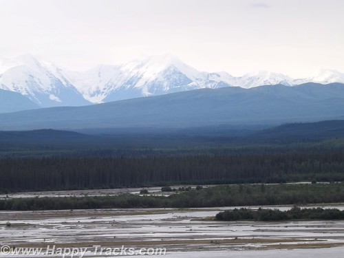
The scenery heading into Fairbanks includes mountains in the distance but more consistent snow cover than we’d seen earlier. Our first stop in Fairbanks was another viewing point of the pipeline with an informational display. You can also see where the pipeline goes underground here.
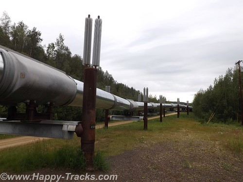
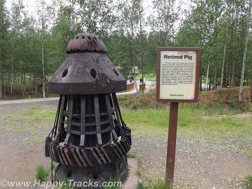
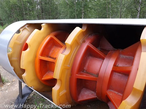
They regularly measure the flow through the pipeline to determine ways they can improve efficiency. One of the steps they employ is to periodically clean the pipes of accumulated sludge using a pipeline inspection gauges or “pig”. A pig is essentially a phenolic plug that travels along and cleans the insides of the pipe.
Fairbanks grew out of a trading post on the Chena River established around 1901 with the landing of the river boat Lavalle Young. The discovery of gold in the hills north of town in 1902 assured its success. By 1907, railroads had largely replaced the riverboats.
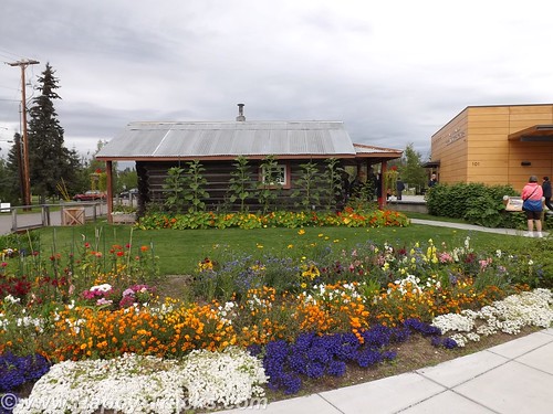
We went into Fairbanks itself with the first stop at the Visitors Center on the banks of the Chena River. On the grounds there is an original cabin from early Fairbanks (pre-1910), still in its original location. The cabin is small, in part to minimize the heating needs while still providing adequate living space for a kitchen, sitting area and sleeping space. It is worth noting that by 1910, Fairbanks had limited electric and telephone service in place.
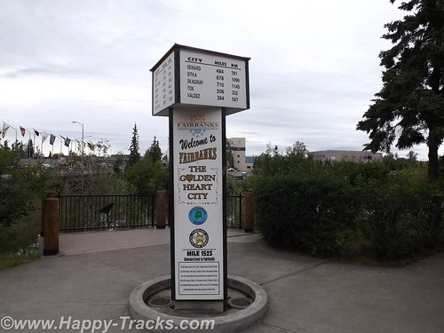
In downtown Fairbanks, there is another marker for the Alaska Highway at 1523 miles. Since much of the military traffic on the highway during WWII was destined for the military bases there, some measure the highway from Dawson Creek to Fairbanks.
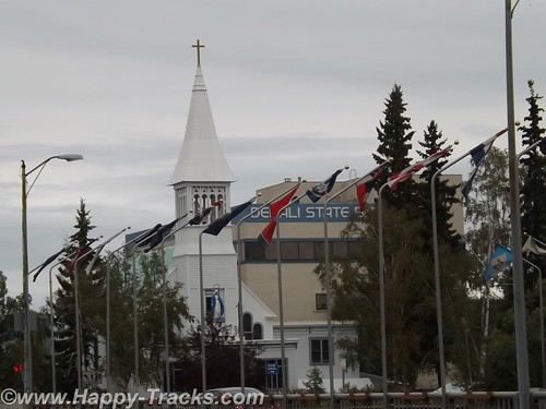
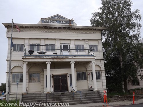
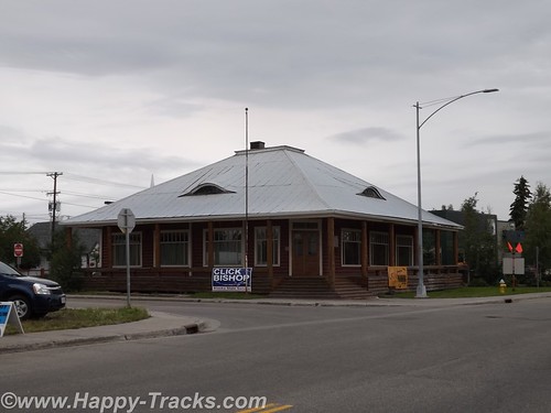
Several historic buildings remain in downtown, including the Oddfellows Hall, formerly a bath house and health clinic and the Masonic Lodge nearby. Located in the old Oddfellows Hall building is the Alaska Mining Hall of Fame Foundation museum. Admission is by donation. The museum is still getting itself organized but holds memorabilia of the mining industry including some very clear explanations of the different methods of mining used. There is also a gift shop and display devoted to the Iditarod dog sled race.
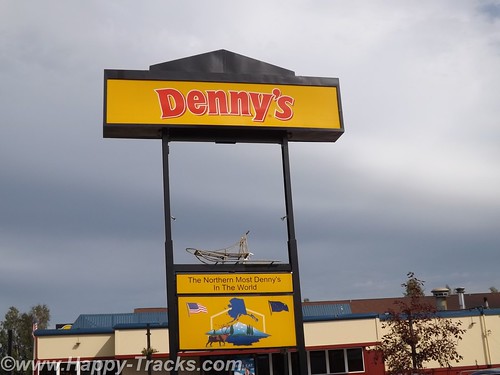
We checked into our motel and grabbed dinner at the Denny’s located next door. This particular Denny’s has the distinction of being the northernmost Denny’s in the world!
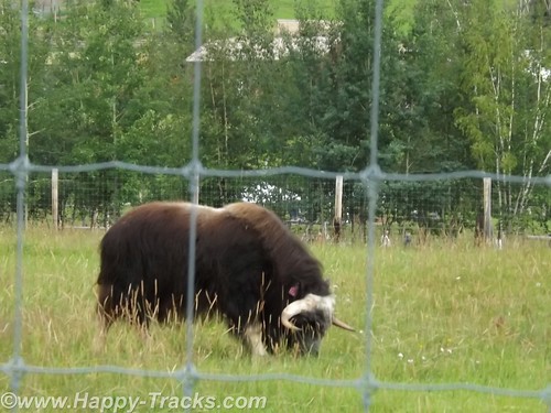
The University of Alaska Fairbanks (UAF) campus was near our lodgings. Just a couple of miles further down the road is the Large Animal Research Station (LARS) specializing in high latitude biology, particularly muskox and caribou. LARS is open for tours and we availed ourselves.
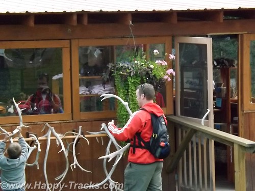
The LARS tours are run by University personnel who are specialists in the animals. They also have a small gift shop, a picnic area and some vintage farm equipment. We watched a family whose children were absolutely fascinated with the antler collection and the old tractors while we waited for our tour to begin.
The day we were there, they also had mosquitoes. Betty has always been something of a magnet for mosquitoes which has detracted from the enjoyment of many outside activities. Today we tried the Off! Clip-on Fan and it worked. While we stood talking to another couple who were also touring (they were in a big 5th wheel camper), you could see the difference in the swatting. It was noticeable enough the lady asked what Betty was using. The Off! fan is available in a drug and discount stores including Home Depot and we recommend it! They last about 12 hours of use but seal when you turn them off so you can use it for up to two weeks after initially opening the refill.

Muskox have horns that loop down similar to a water buffalo although not as long. Muskox also have wool which they shed (no need for shearing) that is among the softest stuff in the world. A hat or scarf made of quivit will make cashmere seem coarse. Unlike many wools, quivit does not shrink. We would visit a shop in Anchorage where handmade items were available for shopping.
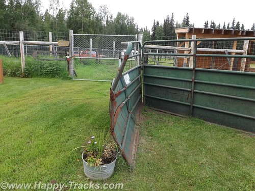
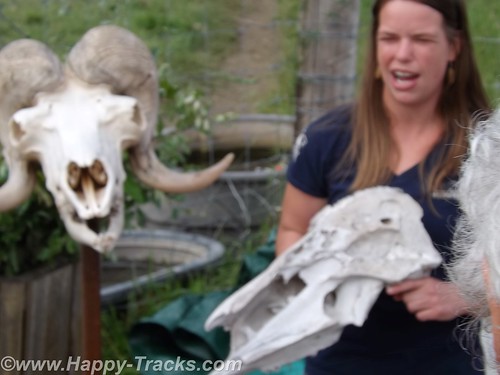
Muskox have very thick skulls and generally will defend their territory or herd by butting heads. LARS has a gate that shows just how much force is available through that thick skull. In the wild, muskox will defend the herd by backing into a circle, heads out, with the youngsters in the circle. A tightly packed circle of muskox is a formidable force.
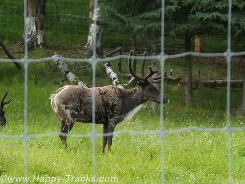
LARS also has caribou which are very similar to reindeer. In fact, according to the guide, the principle difference in a caribou and a reindeer is that reindeer are domesticated. She actually raised the question whether their caribou still qualified since they were penned.
We also learned the difference in horns and antlers (which you may have already known). Antlers grow each year and are shed while horns are permanent.
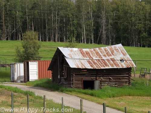
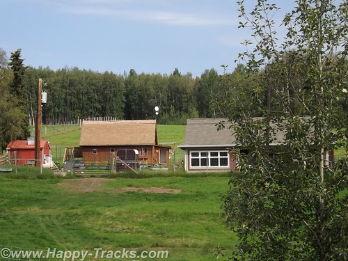
The farm is staffed year round to care for the animals and the property. On site, there are several buildings ranging from the old barn to a modern quarters for the caretakers.
Next we went to visit the main campus of UAF and the Museum of the North. The exterior of the building resembles the overlapping plates of the ground. It shares some similarity to the iconic shape of the Sidney Opera House.
The Museum displays are divided geographically and to coincide with the four main groups of Native Alaskans. As we walked into the main exhibit room, we saw the only grizzly (brown) bear we would see on the trip.
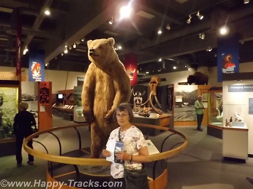
There were exhibits of archaeological significance like the fossilized mammoth and of cultural significance like the totems and clothing. There were also exhibits of the historical events such as the gold rush and the oil exploration.
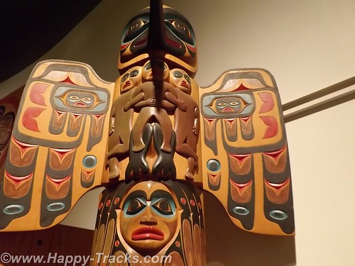
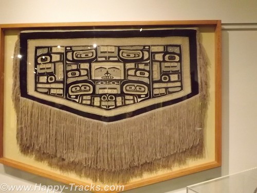
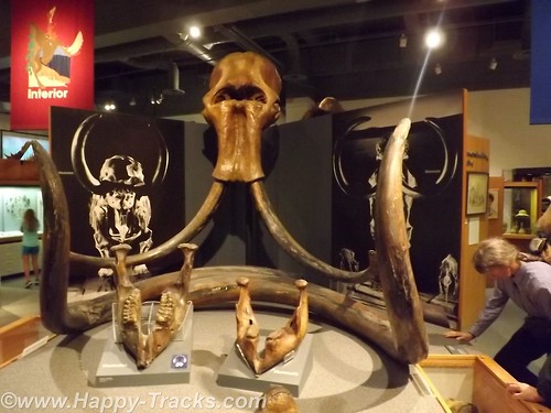
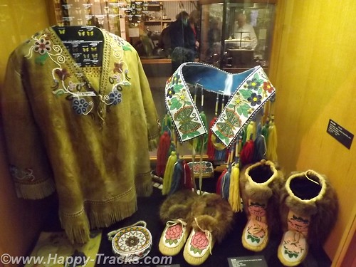
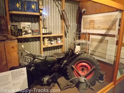
There was also an exhibit dedicated to the Japanese occupation of the Aleutians during WWII and the relocation/interment of those persons of Japanese ancestry during that period.
The museum had a gift shop with a wide array of items from kids plastic toys to hand-crafted display items. As befitting a museum, it included books and some household and kitchen goods with thematic decorations.
On the grounds, was the restoration of the Russian blockhouse which dates back to the Russian ownership of the territory. The blockhouse was part of the fort when the Russians were primarily trapping for pelts.
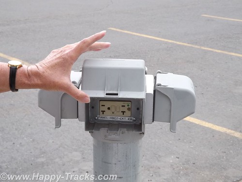
One other item we noticed was the electrical outlets in the parking area. I suppose when the winter temperatures plummet, plugging your car’s block or battery heaters may be the only hope you have of restarting the car for the trip home.
We headed back to the hotel for the night. The next morning we shared a conversation with one of the many motorcyclists we had encountered on our trip. This particular gentleman (around our age) was hanging around the hotel because he had fallen off his bike and had a spine compression injury which left him feeling unsafe and uncomfortable making the trip home on his bike. He had checked into the costs of shipping his bike back to Seattle and it was to be about $500. One of the others in his group had suffered some sort of cardiovascular attack and he was waiting to find his prognosis and plans. Perhaps they could share the cost of the freight back home.
You can see all of the pictures from this leg of the trip here.
We invite you to continue along with us and hope you enjoy the account!
