Summer 2014: Alaska via the AlCan; Flight 93 Memorial and Home Again, Wrap Up

We are often given to rushing the last part of the trip wherever we go. A trip to visit family In Florida will sometimes turn into a marathon one day ride home. A trip to the beach will find us looking at each other late in the evening and saying “let’s just go on home” and arriving at midnight. Aware of this tendency, we tried not to do it this time. One consequence of that behavior is that we often don’t visit the places closer to home while telling ourselves we’ll visit as a day trip from home and then keep putting it off until later.
DSCF9218
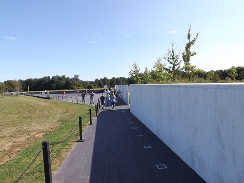
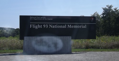
This time, prompted by pictures shared by our friend Tra Maslar, we stopped instead of driving past the Flight 93 Memorial in Stony Creek township, 2 miles north of Shanksville PA. We stopped for lunch in Shanksville and then followed the signs to the Memorial.
DSCF9213
Being recent history, most of us remember where we were and what we were doing when Flight 93 crashed on September 11, 2001. Briefly, of the four aircraft hijacked by terrorists on September 11, Flight 93 is the only one that did not reach its intended target, presumed to be the US Capitol building in Washington, DC. Several passengers and crew members made telephone calls aboard the flight and learned about the attacks on the World Trade Center and the Pentagon. The passengers decided to mount an assault against the hijackers and wrest control of the aircraft to prevent it reaching its target. While successful, all 44 people onboard (including the four hijackers) died in the process.
DSCF9215
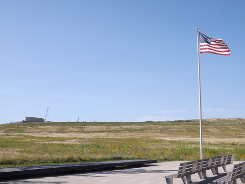
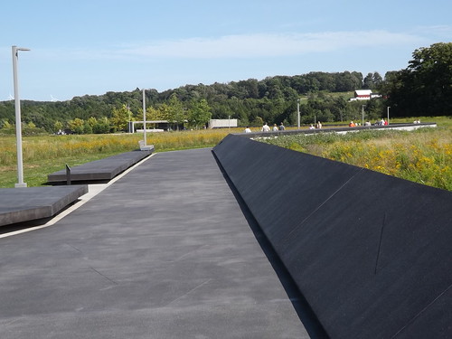
We have visited the memorials at WTC and Pentagon sites. Flight 93 crashed in a field in the countryside. The memorial itself is predominantly built but the supporting structures (visitor center and grounds) are still under construction. Since our visit, a fire at the NPS administration building has destroyed the flag that flew over the Capitol that day but most of the remainder of the memorial collection is safe.
DSCF9217
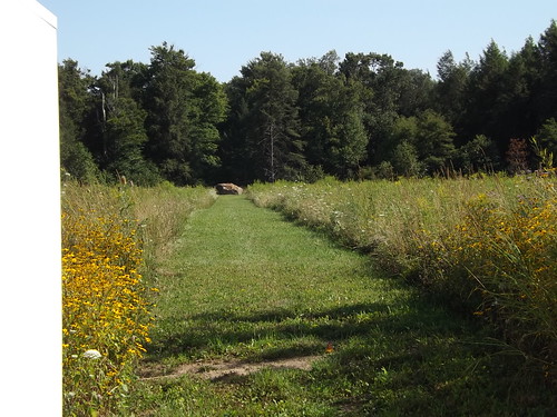
Each of the 40 heroes are named on one of the white stones at the right above. Looking at the site from this vantage point, you are looking along the path the airplane took as it crashed and went along the ground, stopping near the boulder shown in the picture below.
DSCF9221
DSCF9222
Although it’s been 13 years, the memorial still tugs at some tender spots and memories of that awful day. The memorial is a fitting tribute to those 40 brave men and women who sacrificed themselves for others.
OH2MD_map

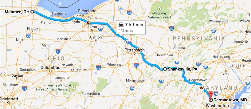
11,704 driven miles later, we are home. Looking forward to sleeping in our own bed. We appreciate how truly blessed we are to live in such a beautiful place and to have the time, money and health to make this trip together.

  • We live in a great and beautiful country. Get out there and see it while you can.
  • Schedules and reservations have their advantages but the spontaneity of driving until you’re ready to stop will lead to some worthwhile surprises. If things aren’t going according to plan, revise the plan instead of spinning up. It may work out even better than planned.
  • It was a surprise to us how many places have WiFi. Although of varying quality, its often free. Some places don’t have food nearby but have WiFi.
  • Cell phone coverage is pretty good even in sparsely populated areas but the cost of using your phone internationally can be steep. Surprisingly, the OnStar phone in the truck was the lowest per minute price while in Canada although it was high-priced for US usage.
  • Most hotels are non-smoking these days but it was surprising to us how many of the large chains had smoking rooms.
  • People are friendly. If you take the time to talk to them or make yourself open to conversation (in some cases that means a willing listener), its easy to be part of a conversation even when you don’t know anybody. Everyone has a story if you’re willing to listen to it.
  • Preparing for the unexpected is a plus. Two spare tires are not too many. Two batteries are not too many. A refrigerator/freezer with some food comes in handy.
  • A suitcase full of clothes for all kinds of weather proved to be superfluous.
  • I still think that tollroads need to have an option for pay as you go with cash.
  • A supply of cash is handy but using a credit card with the credit union making the conversions can be economical.
  • Hotels may vacuum daily and wipe down the horizontal surfaces but the carpets need to be cleaned (shampooed) once in a while.
  • Take the time to poke around the small town off the interstate even if you’re just stopping for gas or food.
  • We stop about every 2 hours and get out, even for a few minutes. We both feel better at the end of the day.
  • It bears repeating – Get out there and enjoy it now.

You can see all of the pictures from this leg of the trip here.
Don’t forget the trip calendar we put together at CafePress. We think it turned out pretty well and would make a great holiday gift. calendar
Thanks for following along and your comments. We hope its been worth your time.
Where shall we go next?

Summer 2014: Alaska via the AlCan; Little Big Horn National Monument

Little Big Horn National Monument sets in south central Montana far away from any large cities. We stayed overnight in Hardin, MT about 16 miles away on the edge of the Crow Agency land.
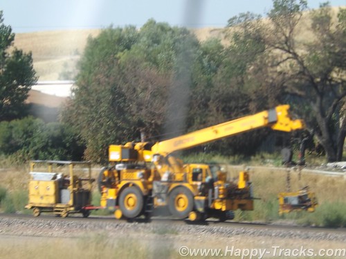
Paralleling (roughly) the highway between Hardin and the monument is a railroad track which might not generally be notable but this particular day there was a convoy of track maintenance equipment on the move and we got a couple of pictures since we usually see this type of equipment waiting to go rather than moving down the track.
DSCF8992
Little Big Horn National Monument memorializes the U.S. Army’s 7th Cavalry and the Sioux and Cheyenne in a famous battle. During the course of our visit, we heard about the actual battle as well as some perspective on how the battle came to be.
For the most part, the battlefield is just the landscape. There are markers, a road, the visitors’ center and a veterans’ cemetery. It is a place where quiet introspection and retrospection is possible.
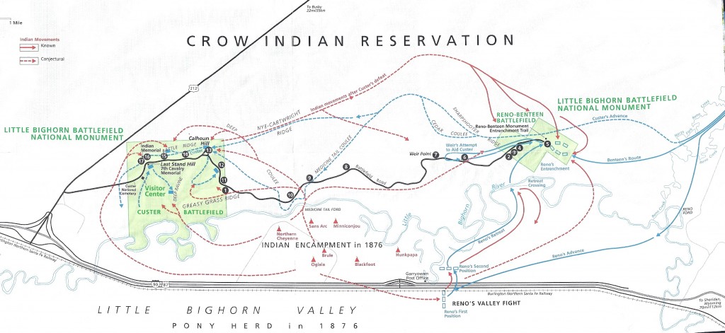
lbhmap
The map above is from the NPS information sheet. I suggest you enlarge it in a separate window or tab for reference.
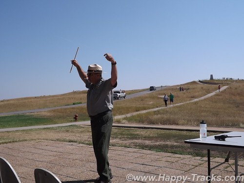
At our hotel the night before, one of the other guests told us about the interpretive ranger presentation and recommended we attend. Ranger Interpreter Adelson gave quite an animated presentation of the battle. So animated that at the conclusion, he needed to sit down and recuperate a bit before fielding questions. Very impressive.
DSCF9012
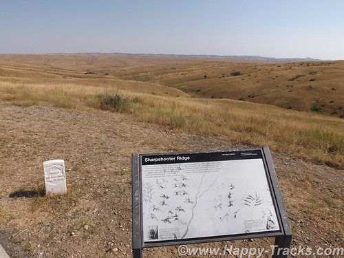
The Battle of the Little Bighorn was fought in a landscape of ridges, steep bluffs, and ravines of the Little Bighorn River. The combatants were warriors of the Lakota Sioux, Northern Cheyenne, and Arapaho tribes, battling men of the 7th Regiment of the U.S. Cavalry. The Battle of the Little Bighorn has come to symbolize the clash of two vastly dissimilar cultures: the buffalo/horse culture of the northern plains tribes, and the highly industrial/agricultural based culture of the U.S. This battle was not an isolated soldier versus warrior confrontation, but part of a much larger strategic campaign designed to force the capitulation of the nonreservation Lakota and Cheyenne.
In 1868, many, but not all, Lakota leaders agreed to a treaty, known as the Fort Laramie Treaty that created a large reservation in the western half of present day South Dakota and required that they give up their nomadic life and settle into a stationary life, dependent on Government-supplied subsidies. The stationary life on the reservation would have the added benefit of avoiding conflict with other tribes in the region, with settlers, and with railroad surveys. Lakota leaders such as Sitting Bull and Crazy Horse rejected the reservation system as did many roving bands of hunters and warriors and felt no obligation to conform to the treaty restrictions, or to limit their hunting to the land assigned by the treaty. Their sporadic forays off the set aside lands brought them into conflict with settlers and enemy tribes outside the treaty boundaries.
DSCF9003
Tension escalated in 1874, when Lt. Col. Custer was ordered to make an exploration of the Black Hills inside the boundary of the Great Sioux Reservation. He was to map the area including identifying a suitable site for a future military post. During the expedition, professional geologists discovered deposits of gold. Word of the discovery of mineral wealth caused an invasion of miners and entrepreneurs to the Black Hills in direct violation of the treaty of 1868. The government made attempts to keep the settlers out of the Black Hills but that was unsuccessful. The U.S. negotiated with the Lakota to purchase the Black Hills, but the offered price was rejected by the Lakota as the land was sacred to the Indians. The climax came in the winter of 1875, when the Commissioner of Indian Affairs issued an ultimatum requiring all Sioux to report to a reservation by January 31, 1876. The deadline came with virtually no response from the Indians, and matters were handed to the military.
DSCF9005
General Philip Sheridan, commander of the Military Division of the Missouri, devised a strategy that committed several thousand troops to find and to engage the Lakota and Cheyenne, who now were considered “hostile”, with the goal of forcing their return to the Great Sioux Reservation. The campaign was set in motion in March, 1876, when the Montana column, a 450 man force of combined cavalry and infantry commanded by Colonel John Gibbon, marched out of Fort Ellis near Bozeman, Montana. A second force, numbering about 1,000 cavalry and infantry and commanded by General George Crook, was launched during the last week of May, from Fort Fetterman in central Wyoming. In the middle of May, a third force, under the command of General Alfred Terry, marched from Fort Abraham Lincoln, Bismarck, Dakota Territory, with a command comprised of 879 men. The bulk of this force was the 7th Cavalry, commanded by Lt. Col. George Armstrong Custer.
It was expected that any one of these three forces would be able to deal with the 800-1,500 warriors they likely were to encounter. The three commands of Gibbon, Crook, and Terry were not expected to launch a coordinated attack on a specific Indian village at a known location. Inadequate, slow, and often unpredictable communications hampered the army’s coordination of its expeditionary forces. Furthermore, it must be remembered that their nomadic hunting put the Sioux and their Cheyenne allies constantly on the move. No officer or scout could be certain how long a village might remain stationary, or which direction the tribe might choose to go in search of food, water, and grazing areas for their horses.
The tribes had come together for a variety of reasons. The well watered region of the Powder, Rosebud, Bighorn, and Yellowstone rivers was a productive hunting ground. The tribes regularly gathered in large numbers during the spring to celebrate their annual sun dance ceremony. The sun dance ceremony had occurred about two weeks earlier near present day Lame Deer, Montana. During the ceremony, Sitting Bull received a vision of soldiers falling upside down into his village. He prophesied there soon would be a great victory for his people.
DSCF8996
On the morning of June 25, the camp was ripe with rumors about soldiers on the other side of the Wolf Mountains, 15 miles to the east, yet few people paid any attention. In the words of Low Dog, an Oglala Sioux, “I did not think anyone would come and attack us so strong as we were.”
On June 22, General Terry decided to detach Custer and his 7th Cavalry to make a wide flanking march and approach the Indians from the east and south. Custer was to act as the hammer, and prevent the Lakota and their Cheyenne allies from slipping away and scattering, a common fear expressed by government and military authorities. General Terry and Colonel Gibbon, with infantry and cavalry, would approach from the north to act as a blocking force or anvil in support of Custer’s far ranging movements toward the headwaters of the Tongue and Little Bighorn Rivers. The Indians, who were thought to be camped somewhere along the Little Bighorn River, “would be so completely enclosed as to make their escape virtually impossible”.
DSCF9014
On the evening of June 24, Custer established a night camp twenty-five miles east of where the battle would take place on June 25-26. The Crow and Arikara scouts were sent ahead, seeking actionable intelligence about the direction and location of the combining Lakota and Cheyenne. The returning scouts reported that the trail indicated the village turned west toward the Little Bighorn River and was encamped about twenty-five miles west of the June 24 camp. Custer ordered a night march that followed the route that the village took as it crossed to the Little Bighorn River valley. Early on the morning of June 25, the 7th Cavalry Regiment was positioned near the Wolf Mountains about twelve miles from the Lakota/Cheyenne encampment along the Little Bighorn River. Today, historians estimate the village numbered 8,000, with a warrior force of 1,500-1,800 men. Custer’s initial plan had been to conceal his regiment in the Wolf Mountains through June 25th, which would allow his Crow and Arikara scouts time to locate the Sioux and Cheyenne village. Custer then planned to make a night march, and launch an attack at dawn on June 26; however, the scouts reported the regiment’s presence had been detected by Lakota or Cheyenne warriors. Custer, judging the element of surprise to have been lost, feared the inhabitants would attack or scatter into the rugged landscape, causing the failure of the Army’s campaign. Custer ordered an immediate advance to engage the village and its warrior force.
At the Wolf Mountain location, Custer ordered a division of the regiment into four segments: the pack train with ammunition and supplies, a three company force (125) commanded by Captain Frederick Benteen, a three company force (140) commanded by Major Marcus Reno and a five company force (210) commanded by Custer. Benteen was ordered to march southwest, on a left oblique, with the objective of locating any Indians, “pitch into anything” he found, and send word to Custer. Custer and Reno’s advance placed them in proximity to the village, but still out of view. When it was reported that the village was scattering, Custer ordered Reno to lead his 140 man battalion, plus the Arikara scouts, and to “pitch into what was ahead” with the assurance that he would “be supported by the whole outfit”.
The Lakota and Cheyenne village lay in the broad river valley bottom, just west of the Little Bighorn River.
DSCF8999
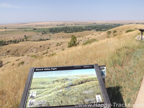
As instructed by his commanding officer, Reno crossed the river about two miles south of the village and began advancing downstream toward its southern end. Though initially surprised, the warriors quickly rushed to fend off Reno’s assault. Reno halted his command, dismounted his troops and formed them into a skirmish line which began firing at the warriors who were advancing from the village. Mounted warriors pressed their attack against Reno’s skirmish line and soon endangered his left flank. Reno withdrew to a stand of timber beside the river, which offered better protection. Eventually, Reno ordered a second retreat, this time to the bluffs east of the river. The Sioux and Cheyenne, likening the pursuit of retreating troops to a buffalo hunt, rode down the troopers. Soldiers at the rear of Reno’s fleeing command incurred heavy casualties as warriors galloped alongside the fleeing troops and shot them at close range, or pulled them out of their saddles onto the ground.
Reno’s now shattered command recrossed the Little Bighorn River and struggled up steep bluffs to regroup atop high ground to the east of the valley fight. Benteen had found no evidence of Indians or their movement to the south, and had returned to the main column. He arrived on the bluffs in time to meet Reno’s demoralized survivors. A messenger from Custer previously had delivered a written communication to Benteen that stated, “Come on. Big Village. Be Quick. Bring Packs. P.S. Bring Packs.” An effort was made to locate Custer after heavy gunfire was heard downstream. Led by Captain Weir’s D Company, troops moved north in an attempt establish communication with Custer.
Assembling on a high promontory (Weir Point) a mile and a half north of Reno’s position, the troops could see clouds of dust and gun smoke covering the battlefield. Large numbers of warriors approaching from that direction forced the cavalry to withdraw to Reno Hill where the Indians held them under siege from the afternoon of June 25, until dusk on June 26. On the evening of June 26, the entire village began to move to the south.
The next day the combined forces of Terry and Gibbon arrived in the valley bottom where the village had been encamped. The badly battered and defeated remnant of the 7th Cavalry was now relieved. Scouting parties, advancing ahead of General Terry’s command, discovered the dead, naked, and mutilated bodies of Custer’s command on the ridges east of the river. Exactly what happened to Custer’s command never will be fully known. From Indian accounts, archeological finds, and positions of bodies, historians can piece together the Custer portion of the battle, but not with absolute certainty.
DSCF8998
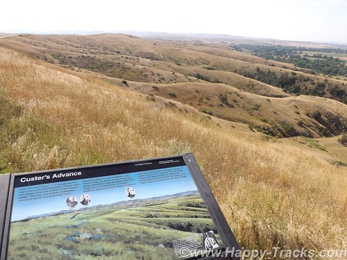
It is known that, after ordering Reno to charge the village, Custer rode northward along the bluffs until he reached a broad coulee known as Medicine Tail Coulee, a natural route leading down to the river and the village. Archeological finds indicate some skirmishing occurred at Medicine Tail ford. For reasons not fully understood, the troops fell back and assembled on Calhoun Hill, a terrain feature on Battle Ridge. The warriors, after forcing Major Reno to retreat, now began to converge on Custer’s maneuvering command as it forged north along what, today, is called Custer or Battle Ridge.
Dismounting at the southern end of the ridge, companies C and L appear to have put up stiff resistance before being overwhelmed. Company I perished on the east side of the ridge in a large group, the survivors rushing toward the hill at the northwest end of the long ridge. Company E may have attempted to drive warriors from the deep ravines on the west side of the ridge, before being consumed in fire and smoke in one of the very ravines they were trying to clear. Company F may have tried to fire at warriors on the flats below the National Cemetery before being driven to the Last Stand Site.
About 40 to 50 men of the original 210 were cornered on the hill where the monument now stands. Hundreds of Lakota and Cheyenne warriors surrounded them. Toward the end of the fight, the soldiers killed their horses and used their bodies as defensive shielding. In the end, the warriors quickly rushed to the top of the hill, cutting, clubbing, and stabbing the last of the wounded. Superior numbers and overwhelming firepower brought the Custer portion of the Battle of the Little Bighorn to a close.
The battle was a momentary victory for the Sioux and Cheyenne. General Phil Sheridan now had the leverage to put more troops in the field. Lakota Sioux hunting grounds were invaded by powerful Army expeditionary forces, determined to pacify the Northern Plains and to confine the Lakota and Cheyenne to reservations. Most of the declared “hostiles” had surrendered within one year of the fight, and the Black Hills were taken by the U.S. without compensation.
General Custer has often been portrayed as arrogant and somewhat foolish for starting the attack and maybe he was. We were somewhat shocked to overhear a woman telling the child with her to put back the Custer souvenir “You don’t want that. He’s an asshole.” . In the War of Northern Aggression/War Between the States/Civil War (mixed audience here), he was noted for fighting against the odds and winning. His widow was given the table used to sign the surrender papers as testament to his role in ending the war militarily. The National Park Service has a discussion of General Custer’s military career here. There is also a discussion of Chief Sitting Bull here.
In 1879, the Little Bighorn Battlefield was designated a national cemetery administered by the War Department. In 1881, a memorial was erected on Last Stand Hill, over the mass grave of the Seventh Cavalry soldiers, U.S. Indian Scouts, and other personnel killed in battle. In 1940, jurisdiction of the battlefield was transferred to the National Park Service. These early interpretations honored only the U.S. Army’s perspective, with headstones marking where each fell.
The essential irony of the Battle of the Little Bighorn is that the victors lost their nomadic way of life after their victory. Unlike Custer’s command, the fallen Lakota and Cheyenne warriors were removed by their families, and “buried” in the Native American tradition, in teepees or tree-scaffolds nearby in the Little Bighorn Valley. The story of the battle from the Native American perspective was largely told through the oral tradition.
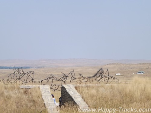
In 1991, the U. S. Congress changed the name of the battlefield and ordered the construction of an Indian Memorial. DSCF9009
In 1996, the National Park Service – guided by the Little Bighorn Battlefield National Monument Advisory Committee, made up of members from the Indian nations involved in the battle, historians, artists and landscape architects – conducted a national design competition. In 1997 a winning design was selected.
Note the term Indian. Its used a lot out here rather than Native Americans or individual nation names. It’s not my intent to offend.

  • 7 December 1886: The site was proclaimed National Cemetery of Custer’s Battlefield Reservation to include burials of other campaigns and wars. The name has been shortened to “Custer National Cemetery”.
  • 5 November 1887: Battle of Crow Agency, three miles north of Custer battlefield
  • 14 April 1926: Reno-Benteen Battlefield was added
  • 1 July 1940: The site was transferred from the United States Department of War to the National Park Service
  • 22 March 1946: The site was redesignated “Custer Battlefield National Monument”.
  • 15 October 1966: The site was listed on the National Register of Historic Places.[4]
  • 11 August 1983: A wildfire destroyed dense thorn scrub which over the years had seeded itself about and covered the site.[5] This allowed archaeologists access to the site.
  • 1984, 1985: Archaeological digging on site.
  • 10 December 1991: The site was renamed Little Bighorn Battlefield National Monument by a law signed by President George H. W. Bush

DSCF9016
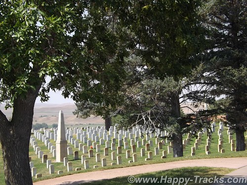
Custer National Cemetery is located at the National Monument grounds. These veterans are from later wars. They stopped accepting new internees in 1978 due to space constraints.
Here are a couple of other Battlefield maps. Open in another tab/window From Smithsonian Magazine
From Mohican Press
You can see all of the pictures from this leg of the trip here.
We invite you to continue along with us and hope you enjoy the account!
butte2glendivemap
Don’t forget the trip calendar we put together at CafePress. We think it turned out pretty well and would make a great holiday gift. calendar

Summer 2014: Alaska via the AlCan, Denali National Park

On leaving Fairbanks, we gave some consideration to traveling north up the Dalton Highway towards the Arctic Circle or even as far as the Arctic Ocean but it came down to making a choice between either of those and having to cut out a day or even two to somewhere else as we had reservations on the weekly ferry ride from Haines in about a week. The side trip just wasn’t worth it so we headed to our next planned destination, Denali National Park.
Denali National Park and Preserve dates back to 1917 when Congress approved the creation of McKinley National Park. While its most famous feature is the tallest mountain in the US, the park and preserve includes 6 million acres of wild country with a single ribbon of road through it. But first we have to get there!
DSCF7436
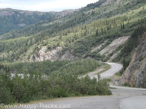
The ride from Fairbanks to Denali started out alternating between relatively flat with mountains in the distance or else riding along higher up with the scenery falling away to either side of the road. We crossed over the Nenana River where there was an old tug boat pulled up along the shore which had pulled freight up and down the river.
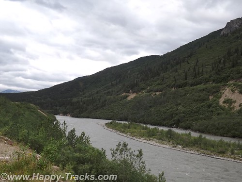
Eventually the road begins the dip into a canyon following the course of the Nenana Creek. We encountered more construction both for roads and bridges. The road construction had a pilot car for a length of unpaved road but the short bridges were controlled by a flagman or a portable traffic light.
DSCF7438
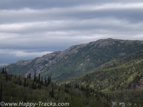
The skies were partly cloudy which resulted in light patterns on the landscape for additional texture.
DSCF7441
Just before we got to the road into Denali, there was a village of hotels, cabins, resorts, stores, and outfitters catering to the tourist trade. They all looked to be doing a good business this day.
Charles Sheldon, a gentleman hunter from Vermont and others lobbied Congress for nearly a decade before persuading them to create Mt. McKinley National Park in 1917. In 1921, Harry Karstens, an outdoorsman and dog musher was hired as the first park superintendent. Gold miners and others in Fairbanks and nearby called the icy granite mountain Mt. McKinley. Sheldon referred to it as “the mountain” or Denali, the Athabascan name meaning the high one. Mt. McKinley is now officially 20,237 feet above sea level, the highest in North America. This figure is 83 feet shorter than the 1952 number (which would have been when my folks were in the area.) There is this interesting article on Discovery.com which talks about why the differences.
Along with the wild landscape there were also animals in the area that were to be protected. Specifically, the Dall sheep in the area were being aggressively killed by market hunters. Per the stories we were told there, the market hunters would kill the sheep they needed to market and would also kill the other sheep around and leave them to rot to limit their competitors ability to provide meat. The National Park and Preserve designation was a small step in providing some control over that situation.
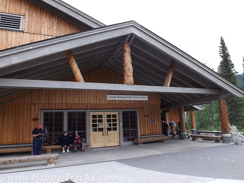
Arriving at the park entrance, the roadway goes to the campgrounds and also to the visitors center. From the visitors center, there are options for interior transportation. There are guided tour buses which travel into the interior of the park and various shuttles to different points within the park.
DSCF7446
We went directly to the visitors center. This is the spot to get acclimated and find out about the various accommodations for getting around. The visitors center also has a small cafeteria and a gift shop. The 85 mile road through the park has access limited to the tour buses and the campers’ shuttles. There are also flight-seeing tours from nearby Talkeetna that take you around, some even land to let you walk around.
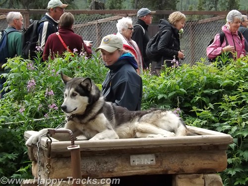
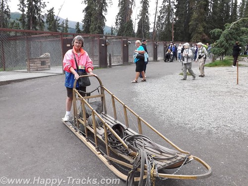
We chose to take the short shuttle to the Sled Dog Kennels. The dogs are working animals at the park providing access to remote areas and support for working and research parties even during the winter months. More about the kennels here.
The bus (similar to school buses) takes you on the 10 minute ride (or it could be except for the stops for road construction) to the kennels. During the summer months, rangers and the dogs demonstrate a working team. Before the demonstrations in the summer, you get a chance to visit with and pet the dogs. Visits and petting are opportunities year round but the demonstrations are summer months only.
DSCF7454
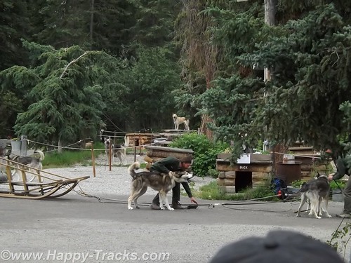
We were surprised to learn that the dogs are controlled by voice command only. For some reason, we had always thought there were reins or similar like larger draft animals.
Each position in the dog team has a specific purpose and different dogs are better suited for each position. Nearest the sled is the wheel dog. The wheel dogs are the strongest and provide momentum to get the sled up on the surface and moving (like getting a boat up on plane).
DSCF7480
In front of the wheel dog is the swing dog. The swing dog provides power but is also trained to swing out on a turn, rather than follow directly in the tracks of the lead dog. The lead dog responds to voice control to turn, go or stop. The dog team may include up to 12 dogs depending on the load and course to be run.
The dogs typically have a 9 year life on the sleds with an average 14 year life span. That link above even talks about adopting retired dogs.

DSCF7468
As an aside, we saw the tourist couple we met at LARS in Fairbanks and said hello.
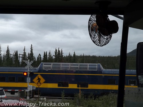
We rode back to the visitors center and decided to take one of the shuttle buses for a brief ride around to the campgrounds. It became more clear that many of the tourists in the park are camping or hiking parts of the large park. While on the shuttle, we stopped at the train crossing to let the Alaska Railroad Denali route train go by. Many tourists will board the train for the ride between Anchorage and Denali with a stop in Talkeetna for more of the beautiful scenery.
DSCF7490
We didn’t really appreciate just how big the park and preserve are. We were unable to see Mt. McKinley from the visitors’ center. We were actually surprised that we asked several of the non-NPS workers which direction the Mountain was and they didn’t know. We’ve since learned Mt. McKinley is about 80 miles southwest from the visitors’ center.
DSCF7494
DSCF7499
DSCF7500
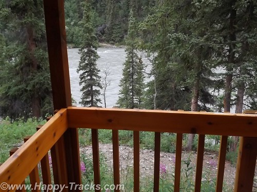
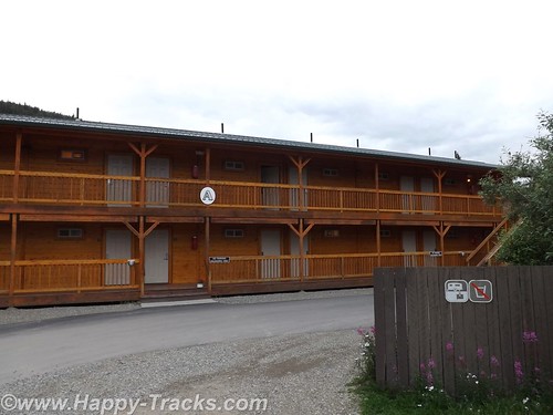
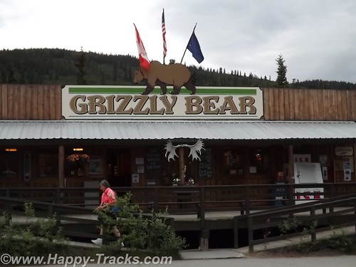
After several hours at the park, we headed out for our accommodations which had been recommended by a fellow on ExpeditionPortal forums. Healy Denali Grizzly Bear Cedar Lodge is just a few miles south of the park entrance (although our GPS directions sent us north instead). The Grizzly Bear Cedar Lodge is away from the cluster of hotels in the village outside the gate and has RV sites, a small general store, a laundromat and a gift shop. The Cedar Lodge itself is set on the banks of the Nenana River. Its not as expensive as the village but doesn’t have all the shops and entertainment within walking distance.
We did get a recommendation for the restaurant just a bit further south, 229 Parks. The food was a more local produce with many non-fried food choices. We had the salmon and the crabcakes and would recommend both the restaurant and lodge to visitors to the area provided you have transportation with you.
DSCF7502
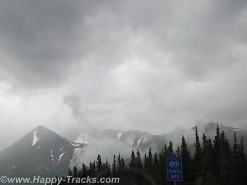
The next morning, we headed south towards Anchorage. We still hadn’t seen Mt. McKinley but there were supposed to be several points along the road where we could see it, weather permitting. As we drove along, we saw fog and clouds where Mt. McKinley should be but we never saw the place where we could get out weather permits and thus left Alaska without seeing the Mountain.
You can see all of the pictures and 2 more short videos from this leg of the trip here.
We invite you to continue along with us and hope you enjoy the account!

Summer 2014: Alaska via the AlCan, Yellowstone National Park

Yellowstone National Park was established in 1872 by Act of Congress and signed by President Grant. It is widely thought to be the first national park in the world. The area was bypassed by the Lewis and Clark Expedition and exploration really started in the late 1860s. Initially, it was overseen by the US Army at Fort Yellowstone in the northern section of the park. Administration passed to the National Park Service following its establishment in 1917.
DSCF6456
We left our cabin in Cody after breakfast and entered the park though the east entrance with plans to make a backward S and leave through the north entrance by day’s end.
DSCF6468
On entering the park, we received our separate handout sheet advising against feeding the animals and telling us that wild animals were dangerous. It also cautioned us to stay in the car when animals were nearby. The road in took us around the shoreline of Yellowstone Lake and into Lake Village.
DSCF6473
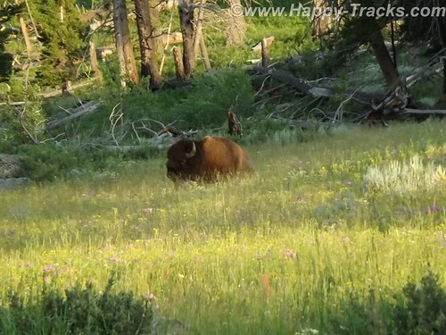
As we could first see the lake, we entered the area of the park where sulphur vents and you could smell it as soon as we entered the region. We stopped by the lake and took a few pictures then headed on towards Lake Village. On the way, there was a car stopped in the road for no apparent reason. As we got closer, we realize that they had stopped and gotten out of the car to take pictures of a bison in the field.
DSCF6476
There was a pulloff nearby and we backed up to it and parked out of the road and took a picture of our own. We learned (and it would be reinforced throughout our trip) that when you see a car stopped, chances are someone has sighted a wild animal, even though the park literature reminds you frequently not to stop in the road.
We continued on to Lake Village where we would find a commercial area (gas, food, restaurants) as well as a visitor center. The ranger at the visitor center gave us the latest updates for expected eruptions at Old Faithful, one of our “must do” sights.
DSCF6478
Shortly after we passed the West Thumb Information Station area and turned to continue on the Grand Loop Road, we were waved down by a young man who had been bicycling. His girlfriend had fallen off her bike and needed assistance. He said she was shaken up and we volunteered to call for help. Punching the OnStar button, we soon were in contact with their personnel who patched us through to emergency services in the park. While we were doing that, another truck stopped. Luckily, it was being driven by an off duty EMT who was able to assess her condition and was drafted to transport her and her bike over to the West Thumb first aid station. We informed the emergency services folks of the resolution and went on our way. While we were glad to be of assistance, we breathed a sigh of relief as we realized we would still be able to make the next eruption of Old Faithful if we got on our way.
DSCF6494
There was a crowd of people there, both for the geyser show and for the lodge, restaurant and shopping area. We found our spot on the viewing deck and waited for the show. As the time drew closer, more people crowded into the area.
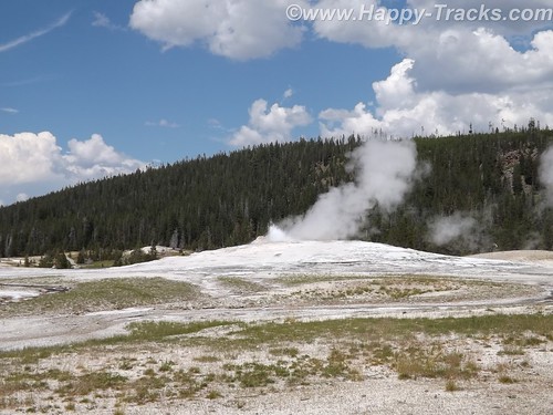
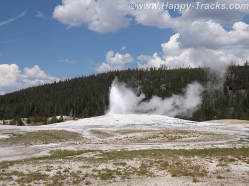
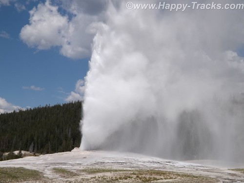
While we were waiting, we saw steam erupting from the other geysers in the area but still we waited for the most famous one. After several smaller spurts and steam, the big show came and we were suitably impressed.
DSCF6506
DSCF6507
DSCF6511
It is truly amazing to watch Mother Earth in action. We had seen pictures and video but its nothing like seeing it in person. One thing that no one ever mentioned was the sound and the noise. Anyone who has ever worked in a steam plant (such as a nuclear submarine) has nightmares about the sound of high velocity steam escaping. Wow.
After the show, we went into the Old Faithful Lodge for lunch and to visit the shops.
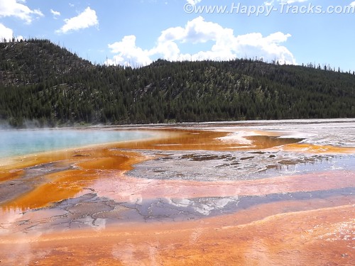
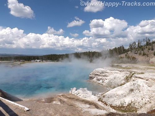
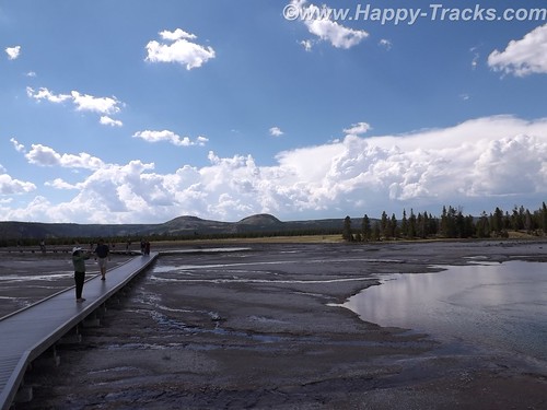
We continued on to the Grand Prismatic Spring. The parking area there is small and was very crowded with folks waiting for others to leave before being able to park. The hot spring is the largest in the US and the third largest in the world. First records of it appear in a trapper’s notes from the 1830s. The colors near the edges are the result of microbes in a mat around the mineral-rich water. The center blue area is sterile due to the heat and its color derives from its depth and purity.
DSCF6538
DSCF6546
DSCF6531
The microbial mat is extremely fragile and there are numerous warnings and prohibitions against walking on or otherwise disturbing the mat. While we were there, someone’s hat blew into the pool. Park personnel remove things like that with poles. On August 2, shortly after our visit, a tourist’s aerial drone mounted camera crashed into the pool. It’s still being investigated about how (or if) to remove it and the owner is facing charges.
Connecting the parking lot and the spring is a pathway that includes a walkway over an ice cold stream fed from the mountains. What a contrast.
DSCF6525
That area is the Midway Geyser Basin and contains the dormant Excelsior Geyser as well.
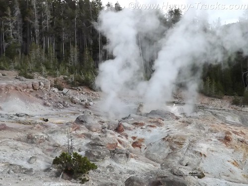
We continued around our backwards S on the Grand Loop Road to visit Steamboat Geyser, the world’s tallest active geyser. It infrequently (and unpredictably) has a major eruption up to 300 feet in the air. It had been almost a year since its last major eruption. It has more frequent minor eruptions, including the day we were there.
DSCF6572
But as we started back towards the truck, the skies let loose and it poured rain. We had umbrellas and windbreaker/rain jackets…back in the truck! So we half walked, half ran back.
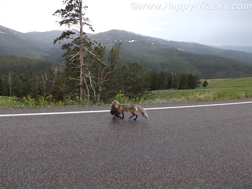
We continued our ride towards the north entrance and saw the now telltale sign of cars stopped along the road. DSCF6578
Animals? Sure enough, we saw this fox with something in its mouth coming along the road. We never were able to identify the prey in its mouth which appeared to be some sort of small mammal.
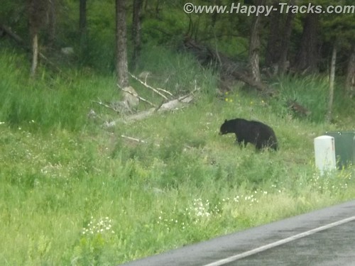
Traveling along, we again saw stopped cars, this time there were a number of them stopped in both lanes of the road. DSCF6584
DSCF6589
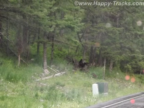
After a bit of sitting and waiting, we realized it was a black bear and three cubs working on crossing the road. Eventually, the adult bear crossed and the three cubs remained on the left side of the road. Then, to our absolute amazement, adults started getting out of their cars –with kids– and started walking up to where the bear and the cubs were on opposite sides of the road! Unbelievable! Finally some of the cars started moving by passing the parked and temporarily abandoned cars. When we were able to move on, the cubs remained on the left, the mother remained on the right and the humans kept on getting out and getting closer.
We stopped at Roosevelt Lodge and Cabins. This was the lodge used by President T. Roosevelt when he visited the area to hunt. There are also cabins, a restaurant and a small camping store there. We kept our comments about the bears and the tourists quiet as we weren’t sure how many of the patrons there had been part of the group. While paying for our purchases at the camping store, we got into a conversation with the clerk who was an older gentleman who had retired to this area from the New Bern area of NC.
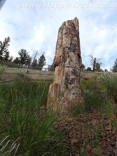
DSCF6591
From there, we visited a petrified redwood tree that is the same as present-day redwoods in California, giving testament to a very different Yellowstone in the distant past.
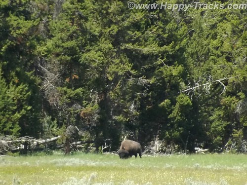
Our next wildlife sighting was another bison standing by himself in a grassy meadow. We found this one by ourselves without the aid of other cars.
DSCF6600
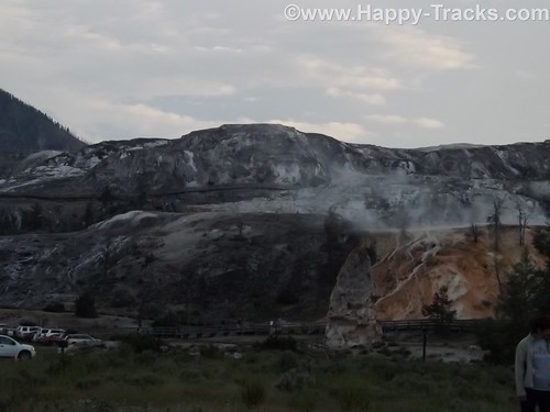
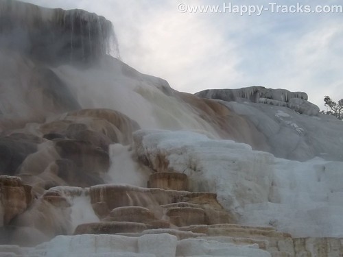
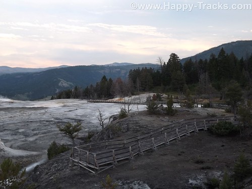
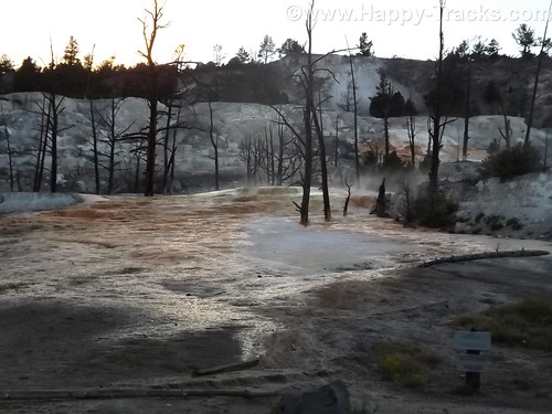
We next arrived at the Mammoth Hot Springs resort and campground at the site of the old Fort Yellowstone. The public buildings are reclaimed barracks and dining facilities. The springs are a series of cascading pools on a hill of travertine.
DSCF6612
DSCF6617
DSCF6626
There is a roadway which winds up the hill and lets you look down on the pools and the historic district. These pools, still more hot springs, really give you a different view than the Prismatic Spring. There was a dormant hot spring cone, Liberty Cap, too.
DSCF6632
DSCF6637

Leaving the Mammoth Hot Springs, you wind down and behind the historic district and onto a winding road out of the park. Just as we reached the boundary, a herd of antelope was crossing the road along the stream bed. Approaching dusk prevents us getting more pictures.
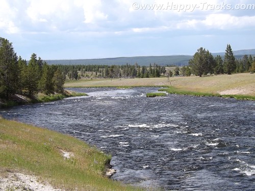
As we exited the park, we followed the Yellowstone River through the canyon to Livingston MT where we found a motel around 11:00. The motel was a Best Western and had a covered garage with a keypad lock for parking which seemed unusual and we never did really figure out why. At first, we suspected the winter weather but it seemed to be the only motel in the area with that feature. It also had an indoor heated pool which our room’s door faced. The humidity outside the room was a reminder of the hot springs we had seen that day.
This is a longer than usual post but it also was a longer than usual day for us. While we don’t advise spending only a day when you get to visit Yellowstone, we proved you could actually see much of it in a day.
You can see all of the pictures from this leg of the trip here.
We invite you to continue along with us and hope you enjoy the account!

Summer 2014: Alaska via the AlCan, Custer SD to Cody WY via the Devils Tower

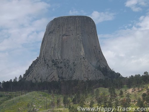
This day’s travel plans included trekking from Custer SD to Cody WY, our gateway to Yellowstone National Park. We were taking a non-direct route that would allow us to visit Devils Tower, America’s first national monument, created by President Theodore Roosevelt under the Antiquities Act in 1906. Devils Tower is also a sacred area for several of the Plains Tribes.
DSCF6385
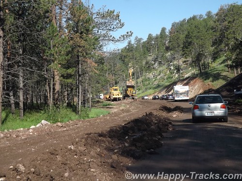
After breakfast and fuel, we hit the road. Route 16 took us through the Black Hills National Forest where the road quickly switched from pavement to dirt and gravel. Very shortly we encountered a stop for construction. Several times we stopped as there was only enough room for one lane of traffic. The pace allowed us to view the scenery and we weren’t in any particular hurry.
DSCF6359
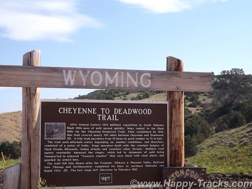
As we neared the National Forest boundary, the construction ended and the road switched back to pavement. Soon after, we crossed the state line into Wyoming and began our approach to Devils Tower.
DSCF6374
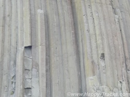
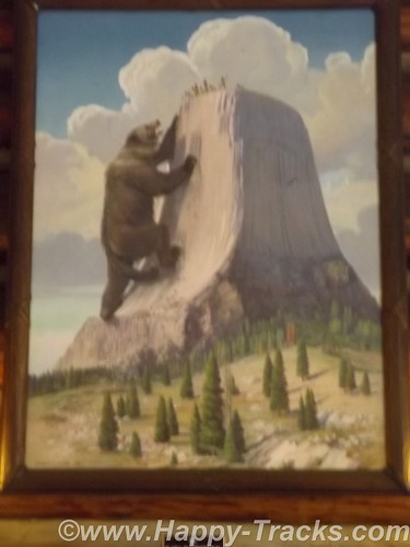
Devils Tower is a column of magma that likely never reached the surface and was later exposed by erosion. The Plains Tribes have varying stories in their lore as to the origins of the tower but they share that that column saved children from being eaten by a giant bear-like creature and that the columns are the results of the bear’s attempts to climb the column.
DSCF6387
DSCF6389

Devils Tower, which attracts about 400,000 tourists a year, is loaded with sacred meaning for about two dozen affiliated tribes of the northern Great Plains. According to their oral tradition, this is the place — historically known to many Indians as Bear’s Lodge/House/Tipi — where a sacred woman, White Buffalo Calf Woman, delivered the sacred bundle to the Lakota, Nakota, and Dakota nations (the three major Sioux subcultures or dialects). This is the place where White Buffalo Calf Woman taught the people how to perform the seven sacred ceremonies (prayer rituals). This is where White Buffalo Calf Woman taught the people how to live in a good way. She also gave them a sacred pipe, and before she left, she promised to return. And then she turned into a white buffalo.

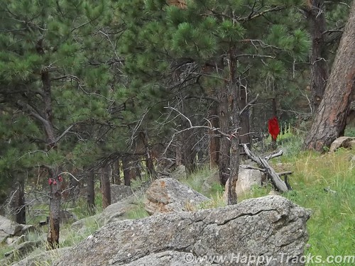
We did see evidence of the sacred beliefs in the form of prayer ribbons and cloths at various places around the base.
DSCF6409
A walk around the base follows a paved path (1.3 miles in length). Wildlife sightings are common — including rattlesnakes– but we didn’t see any during our walk.
DSCF6405
The column is a favored spot for climbers (permits required) and you can see –through an NPS telescope– some of the climbing anchor points up near the top.
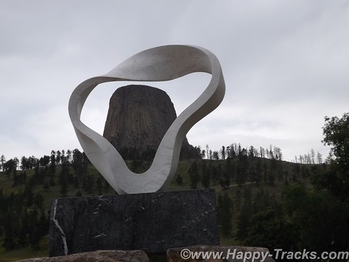
A sculpture was added near the picnic area adjacent to the campgrounds for the Tower’s centennial celebration. The sculpture is called Circle of Sacred Smoke, made by Junkyo Muto. The sculpture is one of seven “peace” sculptures to be donated internationally and calls to mind the sacred pipe.
DSCF6419
After a walk around the column and a visit to the visitors center and gift shop, we headed out for our next destination and had lunch just outside the monument’s gate.
We got back onto I90 and headed to Sheridan where we exited and headed west through the Bighorn National Forest. A rapid increase in elevation as we climbed into and over the Bighorn Mountains via a series of switchbacks.
DSCF6426
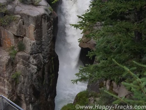
As we started down the far side, we stopped at Shell Falls. The Falls have a parking area and a series of viewing platforms. Interpretive signs explain that the water path that carries water from Shell Falls into the Gulf of Mexico. The stream follows a fault line until the water eventually reaches the Yellowstone River.
DSCF6433
The road travels through the landscape and a series of small settlements and towns until you eventually reach Cody.
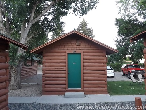
As with most of our trip, we arrived in Cody with no definite plans on where to stay. There is a Comfort Inn, a Holiday Inn and Buffalo Bill’s cabins on the main route. We stopped at the Comfort Inn. Although there were rooms available, the price was (considerably) higher than our budget allowed. As we balked, the desk clerk advised that there were lesser priced cabins available elsewhere but she was not able to give us details. She offered to call someone who could tell us though. Shortly, another lady appeared outside the hotel on a golf cart and offered to show us the Buffalo Bill’s cabins (which were available at about 2/3 the price). What have we got to lose? We followed along.
She took us to adjoining property and showed us a lovely little cabin which had furnishings equivalent to the Comfort Inn. We told her we’d take it and she gave us a ride to the office where we registered. On our ride, she told us she lived in her large RV just on the other side of that fence and came up to Wyoming every summer to work here. She and her husband wintered in Florida somewhere.
DSCF6449
On the bed in the cabin was stuffed bison toy. A clever piece of marketing, the bison was available for sale in the gift shop or could be left. So the family walks in, the kids see the bison and immediately go to it. “Mom! Dad! I want to keep this.” I wonder how many they sell this way?
DSCF6453
Our night in Cody was our first night after letting the bucket washer system work on our clothes. We decided that fewer clothes at a time would work better along with less detergent. We switched to a schedule of one set of outerwear and two sets of underthings and socks with less detergent.
Comfortable bed, good air conditioning and nice chairs to sit in on the lawn. A good night’s sleep to send us on our way.
You can see all of the pictures from this leg of the trip here.
We invite you to continue along with us and hope you enjoy the account!

January 26: Old Friends Touring Locally: Fort Washington — Who Knew?

P1060055 P1060048 DSCN7845 DSCN7843 DSCN7839 DSCN7832 DSCN2944During our last visit with Russ and Father Steve, we had spied something on the eastern side of the Potomac while coming home from Mt. Vernon. A little web research identified Ft. Washington as our target.

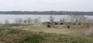
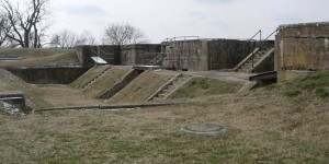
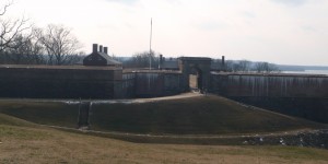
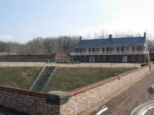
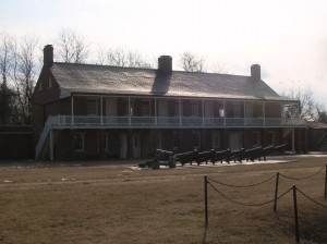
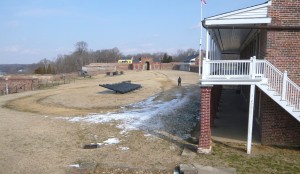
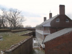
As it turns out, Ft. Washington is still a fort. After all these years of being so close, who knew? Today’s adventure would take us there to see close up. Fort Washington is under the care and ownership of the National Park Service.

Originally the location was home to the Digges estate. The Digges family were friends of George and Martha Washington. In fact, George celebrated his 43rd birthday here. It has been called Warburton Manor. The first military installation was called Ft. Warburton. The site is across the river and slightly upriver from Mt. Vernon. President George Washington suggested it be built. With perpendicular earthen walls, it stood 14 feet above the bottom of a ditch which surrounded the river side of the fort. It included a tower with six cannon overlooking the river. But Ft. Warburton lasted only 5 years.

In August 1814, British forces entered Washington through Bladensburg MD and burned the White House, Capitol and most other government buildings. The next day British warships sailed up the Potomac headed for Alexandria VA. Capt. Samuel Dyson feared Warburton would wind up in British hands so he evacuated and used the powder to destroy the fort. (You may note that Samuel Dyson is not a name you hear in discussions of early American heroes.)

James Monroe, acting Secretary of Defense, engaged Pierre L’Enfant (famous for the layout of Washington) within a month to build a replacement even as the threat diminished with the Treaty of Ghent being signed in December 1814 and the British defeat at the Battle of New Orleans in January 1815. L’Enfant was subsequently dismissed and replaced and the construction was completed in October 1824 at a cost of $426,000 (roughly the price of some of the larger homes in the nearby Ft. Washington community.

As the country moved closer to the Civil War, it became clear that Ft. Washington’s position guarding the capital and across the river from Virginia was more critical. At one time, the fort was under the command of Lt. George Washington Custis Lee, son of General Robert E. Lee. With the growing unrest, he resigned his commission and moved to Virginia. After Lee’s departure, forty Marines were assigned to defend Ft. Washington but were replaced in January 1861 a company of Army recruits. The day after Ft. Sumter fell, the Army’s 1st Artillery took over Ft. Washington. For a time, Ft. Washington stood as the only defense for Washington but was supplemented by a string of 68 enclosed forts and batteries encircling the city.

The fort served during the War of 1812, the American Civil War, the Spanish American War and into the 20th century as a potential defense during both World Wars before reverting to the Department of Interior.

The new fort was designed to serve as a link in the defense of the East Coast of the USA from Naval attack, not just the nation’s capital. During the Civil War, the development of armored ships and rifled cannon shifted the nature of warfare, allowing the ships to approach closer than wooden ships could and to fire rifled cannon which were capable of demolishing brick fortifications and with greater range.
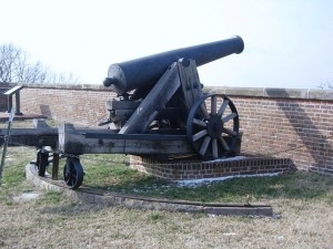
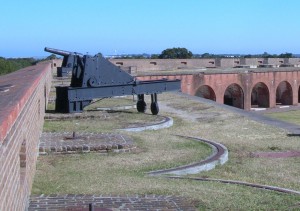
This 24 pounder cannon has an effective range of 1900 yards, almost double the distance to the Virginia shoreline.

This 24 pounder cannon has an effective range of 1900 yards, almost double the distance to the Virginia shoreline. This is all that remains of the fort’s 1861 armament.

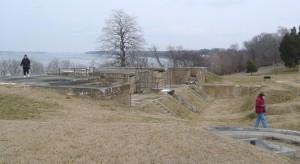
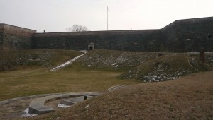
Fort Washington has evolved over the years and is not just one structure but several on the property that were built to meet the changes in strategy and technology. It is also one of only a handful of the seacoast fortifications still in their original form.

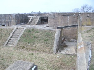
In 1872, the US Army turned the fort over to the Army engineers who constructed new gun positions. In 1896, new concrete batteries were built near the fort for Endicott-era guns, 10-inch rifles on disappearing carriages, 12 inch mortar batteries and 4 inch rifles. Land was purchased and similar batteries were built across on the Virginia side of the Potomac — Ft. Hunt.

In 1921, after the post was no longer needed, it became the headquarters of the 12th infantry. During WWII, the Adjutant General’s Officer Candidate School. was based there. In 1946 the fort was deactivated and became part of the National Park System so that it could be preserved historically and provide recreational opportunities. One Facebook friend says he attended a military school there (or near there) in 2005.DSCN2931
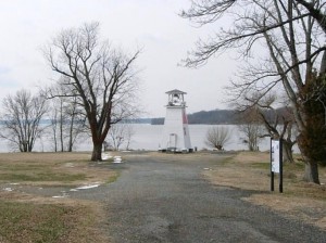
On the point there is also a navigational channel marker which has served as a fog warning.

Our visit was on a cold but sunny day and we started our tour by driving through the park and taking the path down by the river. It’s obvious that the park is used by many nearby residents as a place for walking, bike riding and exercising the dogs.DSCN2925
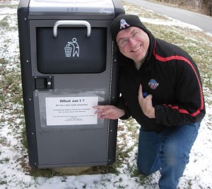
On leaving the car, we came across this trash can with a solar powered compactor.

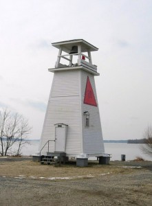
The old light house/fog signal is small (even compared to DSCN2937Massachusetts lighthouses), less than 30 feet high.
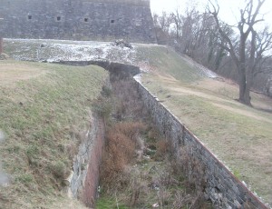
The area between the main fortification and the river has been used over the years for munitions storage, kitchens and later for mounting of cannons and other artillery. From this area is also the entrance called the sally port. Steve walked in this way but found that entrance locked.
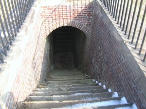
The stairway from the water battery inside the fort.

The stairway from the water battery inside the fort. Doors at the landing below provided protection and thus a sally port.
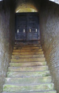
The stairway from the water batter outside the fort

The stairway from the water batter outside the fort. Doors at the bottom and at the top (shown) provided additional security.
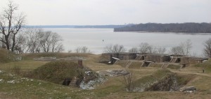
 

DSCN7848

Mt. Vernon lies just beyond the tree-covered point on the right.
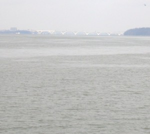
DSCN7821

Looking upriver. The bridge in the distance is the Woodrow Wilson connecting MD to Alexandria VA via I95/495

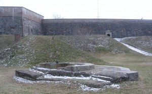
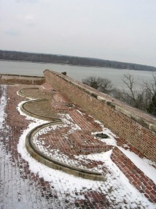
The fort is located on a high point at the juncture of the Potomac River and Piscataway Creek, slightly upriver from Mt. Vernon. This area is known as the Water Battery. In this area were several support facilities for the fort including the powder magazine, storehouse, saddlers shop, blacksmith, stables and the shot house. In the late 19th century, the area underwent major changes as platforms for four fifteen inch guns were added. Later, there were provisions for the Endicott guns. Guns located in this area could ricochet across the water (like skipping rocks) to more directly and accurately hit attacking ships.   DSCN7820 DSCN2953
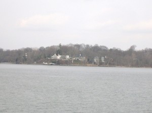
DSCN2943

DSCN2954
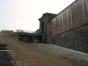
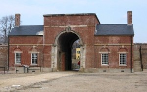
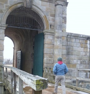
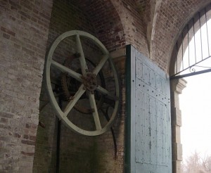
P1060125Two sets of gates protected the main entrance. During renovations made in the 1840s, a drawbridge was added to further protect the entrance. A series of chains and counterweights provided for rapid closure in case of attack from the land side. Additionally, 13 guns provided protection. Gunrooms were built flanking the main entrance (or sally port) to aid in that protection.
P1060063

DSCN2955

DSCN2975

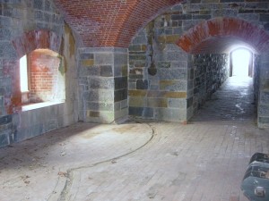
The main entrance or sally port from inside.
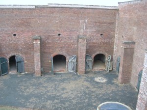
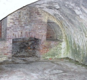
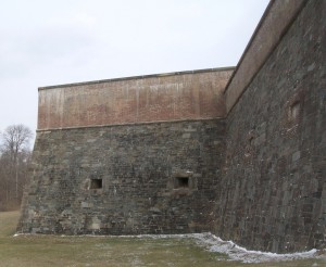
DSCN7857The northwest demi-bastion was designed to contain two levels of guns but only the upper row was installed. The lower level was used by laundresses who lived with their soldier husbands until better quarters were built later. The area was also used for storerooms.
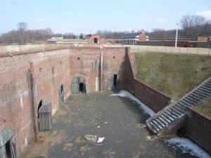
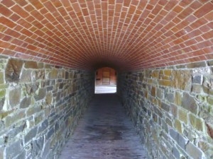
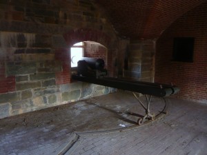
P1060105DSCN2965Also part of the 1840s improvements was the addition of this protected passageway called a capionere which projected from the landside wall and included two levels of guns mounted on swivel tracks to facilitate aiming.
P1060112

P1060113

DSCN2981

P1060114

The capionere also provided a hidden point to keep an eye on the four-legged neighbors.

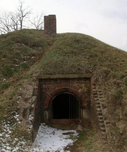
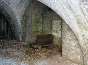
There was also a battery along the outer wall of the ditch surrounding the fort. This provided the capability to fire muskets against attackers who had entered the ditch as well as towards the river.
DSCN2995

DSCN2994

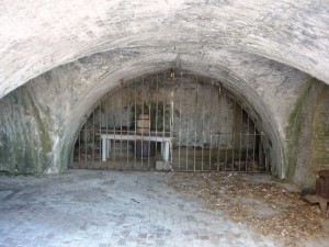
Postern gate, now sealed up

DSCN2993

P1060082

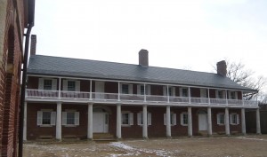
Officers quarters

DSCN2999

Looking across to Enlisted quarters

DSCN7886

Another view across the main parade ground
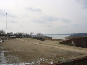
DSCN2966

Looking south across the parade ground from above the front gate. A shed (no longer there) at the far corner provided lookout and control capabilities for the Endicott era mines in the river.
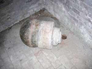
DSCN3010

Part of the river mines system from the late 19th century.
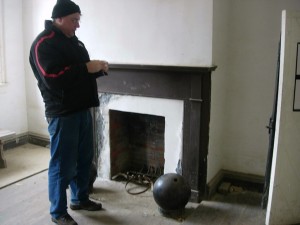
DSCN2960

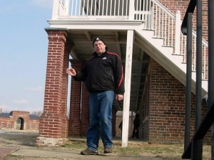
Father Steve with a cannonball in the guard shack.
DSCN2992P1060106DSCN7869DSCN7873DSCN3000DSCN2982

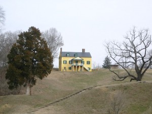
Exiting the fort, you see the visitor center in the yellow house on the hill. DSCN2947 At some point, it was the commanding officers’ quarters but it is not clear during which era. The visitor center contains an audio-vsual presentation as well as some historical
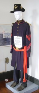
DSCN3013 DSCN3021exhibits. It also contains the highly sought after (at least by Betty) gift shop! On this particular day, it also contained the first place with heat that we had entered since leaving the car.

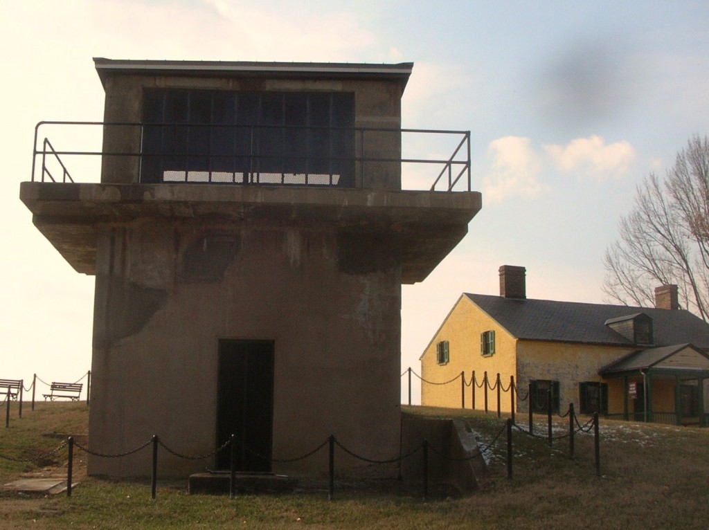
Outside the visitor center is the Battery Commander’s Center (the concrete tower) and Battery Decatur.
DSCN7898
Battery Decatur was completed in 1891 and is made of reinforced concrete. It reflected the shift in defensive structures to rifled projectiles. On the top were mounted 10 inch guns which used the recoil energy to lower the gun out of sight for reloading. The guns had a range of about 7 miles. DSCN3011The lower stories had storerooms for shot, powder and shells and cranes to lift the ordinance to the upper floor guns.
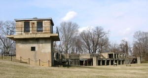
During WWI, the two guns of Battery Decatur were shipped to Fort Monroe Va enroute to use in France. Ft. Washington was garrisoned by the DC Coast Artillery and a number of military units were organized there. The fort was also used as a staging area for troops headed overseas.

Following that, the fort was occupied by the 3rd Battalion 12th Infantry. Its soldies participated in a number of state functions until 1939 when the 3rd Battalion was moved to Fort Myer near Arlington Cemetery. In ’39, the fort was transferred to the Department of Interior and was home to a Civilian Conservation Corps (CCC) barracks.

Following the US entry into WWII, Ft. Washington was returned again to the Department of War. Further expansion occurred with additional buildings for students and to provide support services for training military personnel. The Veterans Administration used part of the area and buildings as public housing.

In 1946, the fort was once transferred to the Department of Interior with may of the WWI and WWII era buildings removed. So far, it has remained a public park since.

After all the tramping around up and down stairs and hills and breathing all the fresh winter air, it was time for a relaxed meal.  So it was over to Proud Mary’s at the Ft. Washington Marina.
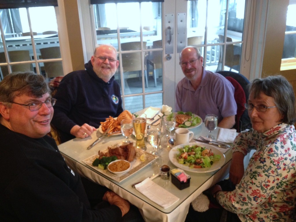
photo7By the time we had finished our meal, it was time to head for home and resume the hotly-contested Uno championship.

November 25: Sometimes, you just gotta get away

It had been a long stretch. Work was busy and vacation time was tight. Some upcoming life changes showed over the horizon but not close enough. We had had it. We’ve got to get out of town and do something different.

Now that we’ve agreed on that, where do we go next? San Diego has been on the list for awhile but you’ve got to make reservations and flights are generally crowded and expensive this close to the holidays. Friends in Texas and along the east coast were due a visit and had been promised one for a while. How about Savannah? We liked it there and wanted to go back, its within driving distance and it should be warmer. Share Thanksgiving and the day after enjoying family and some of the rituals and then load up and leave town.

We pulled into Savannah on Saturday evening after an uneventful ride down I95 and made ourselves at home in the Hilton Garden Inn for several days. There was a wedding reception in the ground floor banquet room and the parking lot was crowded but that didn’t deter us.

Sunday dawned bright and clear. After breakfast at the local Atlanta Bread Co., we headed for Tybee Island. In our previous visit, we had briefly visited just the lighthouse area but wanted to see the rest of the island this time.

As we headed out the causeway towards Tybee, we noticed a sign to Ft. Pulaski Nattional Monument and decided to check it out. Someone’s senior card allowed us to enter at no additional charge.

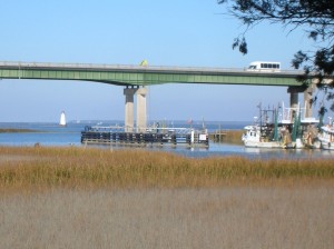
After entering the gate, we drove across a bridge over the old South channel into Savannah and wound our way to the visitors center and the parking lot.

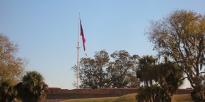
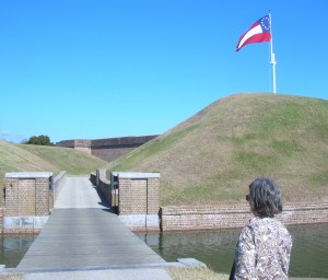
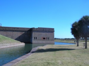
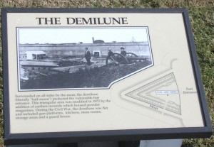
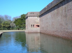
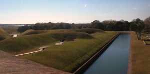
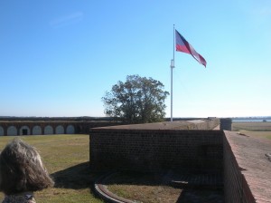
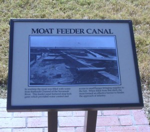
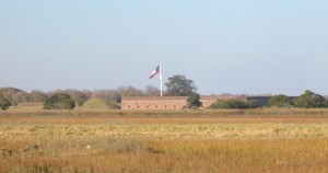
Like most of the forts from this era, the low walls surrounded a modified pentagon shape enclosure. Unlike the others we had seen, Ft. Pulaski was surrounded by a moat, complete with drawbridges. The Park Ranger giving our tour explained that the area outside the fort but within the moat (The Demilune) had never been part of the enclosed fort but had been used for kitchens and in later years for storage of ammunition.

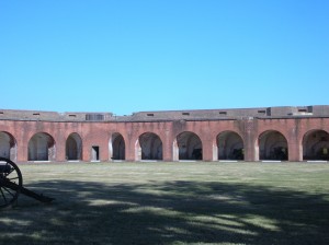
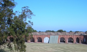
The inner walls showed the standard archways leading to the various rooms of the fort. The picture below replicates a set of barriers put up to help protect the inner rooms from ordnance landing inside the fort walls. The angled wood helped to move the ordnance from the structure and storage areas as well as giving additional strength to the walls.

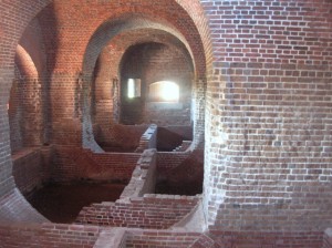
One area showed a partial excavation so you could see the brick structure supporting the wooden floors between the walls. In its life, the fort had been used to garrison troops for the Civil War as well.

DSCN7534This picture also shows the mortar used to fasten the bricks.

Tuck-pointing and repairing old mortar joints remains one of the team’s major focuses inside Fort Pulaski. In the 1930s the Civilian Conservation Corps (CCC) repaired crumbling mortar joints inside the fort using the latest technology, Portland cement, without knowing its damaging effects. However, Portland cement does not allow lime mortar to absorb and release moisture. Thus, the lime mortar is reduced to powder. The weakening mortar leads to cracking and flaking of historic bricks which threatens the overall integrity of the fort.

With more than 25 million bricks, the challenge of preservation and restoration involves removing the Portland cement and replacing it with more traditional lime mortar and natural cements.

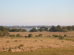
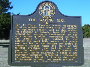
DSCN7524Adjacent to Ft. Pulaski is the lighthouse on Cockspur Island. Savannah history includes multiple references to the Waving Girl, who was known to all the sailors entering the Port of Savannah (but not for reasons that first come to mind of a girl and sailors!)

View from the wall

Old style drawbridge. The chain works for raising and lowering

View of Cockspur Island lighthouse from Old US 80 and the Lazaretto Creek Marina

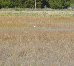
Egret

After leaving Ft. Pulaski, we continued on to Tybee Island. As mentioned above, we had visited here before but stayed up in the vicinity of the lighthouse at the northern end. This time we headed to the extreme southern end of the island and parked the car to walk on the beach.

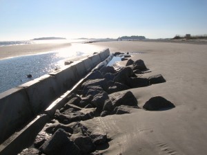
Manmade concrete jetty structure to protect the beach.

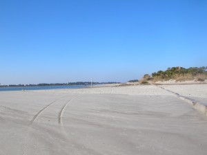
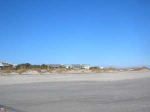
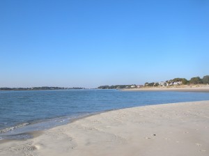
The beach here is very, very flat/gently sloping and has a low duneline as well. It would seem to the untrained mind (like mine) to be very vulnerable to wave action, particularly during storms. Along the beach in several places are jetties, a combination of the concrete structures seen above and huge rocks.

“Time to eat”. So we did!

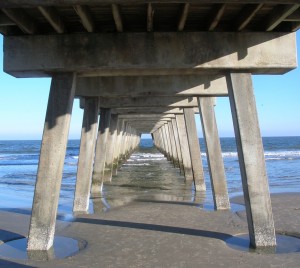
Under the fishing pier

There is a concrete fishing pier and pavilion with vendors in the summer and its available for rent for special occasions. On this day it was pretty much deserted except for a few of us tourists.

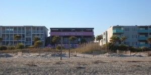
We left via the boardwalk where there were condos/apartments and several businesses including a restaurant/pub with a a big sign saying “time to eat”. We ducked in for coffee and a snack (really good guacamole and empanadas) before making our way back to the car and the ride back to Savannah. They also provided paper-covered tables and crayons to ease the wait.

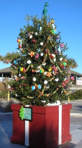
Sea-themed Christmas tree on the boardwalk

By the time we got back to Savannah, it was well on its way to being dark. We headed down towards River St. Parking can be a little tricky but we headed to the public garage under Ellis Square. When we had last visited Savannah, there was a huge (and not attractive) aboveground garage but it was being torn down to be replaced by this underground garage and a rebuilt Ellis Square at street level complete with fountain. There are a couple of daytime pictures in the next couple of postings.

Our dual mission for the evening included dinner and securing something to bring home for Ryan and for the neighbor who watches the house and mail for us. The latter would be solved by a trip to Savannah’s Candy Kitchen for pralines! (If you don’t know what a praline is, you have my sympathy…let’s just say they could be the reason why God made pecans…or maybe pecan pie was the reason.) At any rate, they are a sinful delight made primarily of sugar and pecans. These are some of the best commercially available ones I’ve had. You can order them online at Savannah Candy Company. Miss Edith’s were better to my way of thinking but she’s not around to make them anymore so these are a great substitute

Dinner was also a reprise location from a previous trip, the Riverhouse Restaurant. The plan was to save enough room for dessert but it didn’t work out that way. Their regular dinner menu is tempting and Betty ordered the Scallops Patricia but I was intrigued by the special salmon with an orange glaze. I just had to see how the orange went with the salmon. They were both delicious as were the pumpkin biscuits.  When the waitress returned to ask about dessert, there wasn’t enough room.

Sated, we made our way out to walk along the riverfront. There was a huge freighter going by but the lighting didn’t work out for pictures. The stop to try was enough time for the panhandler to corner us with his palmetto frond rose and his pitch for a donation. We finally gave in and then went on out way back to the car. I couldn’t find the ticket to pay (but didn manage to find one from our last trip). The attendant asked when we had come in and based our charge on that rather than the daily maximum which was appreciated.

We cruised back towards the HGI for the night. There was something going on in the banquet rooms but not as well-attended as the wedding reception from the night before.

Off to bed in preparation for tomorrow’s travels.

Getting An Ugly, Moving off the main roads

There seems to be a pattern to our visits to Buxton. We’ve done it a couple of times before and did again this time. We make the reservations with a day to be home before returning to work and then extend for the extra night. While it doesn’t allow for the day of rest from the trip before returning to work, the extra day of chillin’ at the shore tends to even it all out. The weather was warm and sunny and near perfect beach weather.

After telling the front desk we’d be here another night, we went to the much talked about Orange Blossom Bakery to finally taste the famous Apple Ugly. While I’ve heard lots of folks discuss them, I’ve never really heard anyone say exactly what they are. We were clued in at the party last night that it’s a deep-fried pastry with a sugar glaze that sounded a bit like what we would call an apple fritter. I think what actually convinced us to try them was a recommendation that their coffee was terrific! And sure enough, it was! We recommend the morning blend coffee when you go in for your apple ugly!

Much of the time in our visits has been spent going from place to place, primarily along the beach (when that was an option) or else along Hwy. 12. Recognizing that there was much of the villages that was not along the main highway, we did some exploring back into the residential areas. We started into Buxton Woods where we discovered the elementary school and a new residential facility (perhaps this is the one being built for teacher housing?). We also discovered some of the low hills that make Buxton one of the high spots on the island. We wandered on up to Brigand’s Bay and just beyond in the soundside residential areas.

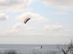
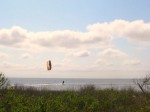
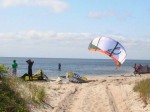
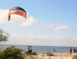
We crossed over to the beach at Blly Mitchell (Ramp 49) where once again, we found the path along the beach limited to only one in and out with a retrace necessary. Heading further north, we stopped for lunch at the Atlantic Coast Cafe (again) by the Avon pier. Last night’s dinner was not a fluke, lunch was also quite good. We looked through the shop at the Avon pier and then moved north along the beach some more and stopped to see the Kinnakeet Life Saving station which has been undergoing restoration for a couple of years now. We went on past it to the sound side where we stopped to watch the windsurfers get underway. It looked a bit like this may have been the conclusion of a class where one of the surfers was doing his solo run. After watching them get going and snapping a few pics, we went into the residential area of Avon and stopped to see the sailboarders zipping back and forth.

We spent some time catching up on the blog and pictures and then went to dinner at the Diamond Shoals where Betty had the Tomato Basil Crab Bisque with nice chunks of crab. Keith went for the salad bar with the gilled shrimp. We finished off with the high chocolate and peanut butter pie! The Diamond Shoals has added a sushi bar and done away with the aquariums. We had heard the large eel had died this past winter.

Back to the room. It appears there are about 5 rooms occupied tonight. We settled in to watch some tv and further typing and picture editing. Looks like we’re headed for home on Monday.

Ocracoke, New Folks and a Hot Idea

The morning started out with a light misty rain which would continue most of the day but the day would end with some new sights and meeting some new people.

We started out with Breakfast at the Hatteras Island Inn and decided to head for Ocracoke. We wanted to do some shopping and look around some in the village where we hadn’t before.

We arrived at the ferry dock at about 20 past the hour, not sure what the schedule was today since we had watched the crossings on Friday being more frequent than the advertised on the hour sailings. As it turned out, they are still on the hour but will put a second boat in service when the need makes itself known. We were to ride the Croatoan, one of the newer, larger ferries with the portion of the deck that’s covered. Sharing the ride with us were some of the folks who are in town for Bike Week in the OBX, the motorcycle kind.


The ferry was to be packed. The motorcycles were not all one big group when they got on but when the crew saw the second contingent of bikes, they had two of the cars back out from under the cover to allow all the motorcycles to be sheltered. Sure it took a few extra minutes but it demonstrates putting your guests’ comfort first with just a little extra effort. Good show!

When we arrived on Ocracoke Island, the rain continued and the line stretched from the dock around the curve, past the visitor parking area. A significant part of the line was motorcycles and their riders waiting in the rain. Well, truth be told, a significant part of the line was motorcycles and their drivers as their passengers stood under the shelter out of the rain. I heard one of the riders relating how she had asked about the priority system which allows residents to jump to the head of the line and why those folks riding motorcycles in the rain didn’t qualify as priority. The story was told with some good nature so let’s give credit. Of course, she hadn’t yet gotten to experience the ferry crew making a space under the cover for the motorcycles and their riders.

We stopped at Howard’s for lunch as per usual, along with many many motorcyclists. Although we usually chow down hearty, we decided to go a bit lighter this time and got a “small” pizza. Small wasn’t especially and their crusts are thick so it filled more than we expected. It was tasty as Howard’s food usually is.

We next went into town to shop at Mermaid’s Folly which seems to be the only place we can find a particular maker of skirt but they had none in the right size this time.

Our next stop was a ride out to the beach and to see the area around the South Point. Plenty of strings and signs and a few fisherman were braving the rain. The rough waters didn’t seem to be helping them at all. We turned and headed north to what I believe may be the only place in the entire Recreation Area where you can ride from one ramp to the next on the beach, that being between ramps 70 and 72. The beach was blocked just north of 70. Cruising up the highway later, it appeared you might be able to enter and exit at ramp 67 as well but you wouldn’t be able to get to the next ramp. Supposedly, under the new ORV plan, the Park Service may add a few ramps to allow some spots where you can enter through one ramp and exit at the next one instead of doubling the traffic as you enter then backtrack to the same point to exit. Time will tell, I guess.

We went back into the village to see some of the backstreets. We went past the school, several inns and shops but none that seemed worth a special stop. So it was back to the ferry and ride over to Hatteras again.

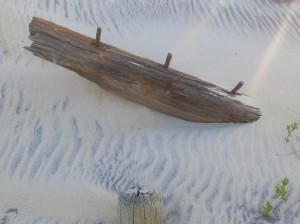
We swung by the Graveyard of the Atlantic Museum which was about to close so we skipped i(hours are 10-4, Monday through Saturday). Next we decided to try again to find the Ramp 55 wreck. Per the latitude and longitude coordinates, we sat on top of the spot but saw nothing.

Net we drove out the pole road and reached the soundside where it became clear how close the channel has shifted to shore. Repeated dredging when you can’t/don’t move the sand any significant distance just doesn’t hold long.

Back to the Hatteras Island Inn and gave a call to Rob Schonk. We had been trying to get together for a face-tot-face this weekend and finally managed to join he and his wife Linda for dinner at the Atlantic Coast Cafe in Avon. Betty had the grilled shrimp and Keith had the special which was crab cake, coconut shrimp and herbed mahi-mahi. We think this may qualify as the best meal we’ve had so far this trip.
After dinner, we horned in on an invitation to meet JAM and some of the folks from the OBC forums at JAM’s place. As I’m horrible with names, I won’t try to name all the folks we met there but will speak highly of the great hospitality and some interesting folks. We are appreciative both for the hospitality and the invite.
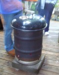
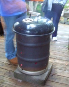
Keith was particularly taken by the bonfire keg which is a stainless steel keg which has had one end removed and vent holes. Very efficient burner and clever idea. Conveniently its also sized right for the grill and lid from a weber. Keith is now on the search for a stainless steel keg for himself.

Considerable discussion of life on Hatteras Island and the ongoing issues with the NPS including the Congressional hearings relative to HR 4094 and a companion bill in the Senate.

Then it was back to the hotel to settle in for the evening.

Transition South, Another Wreck, a Different Beach

Friday was a transition day moving from the northern beaches around Corolla down south to Hatteras Island and our reservations in Buxton.
We started our morning with breakfast at the Hampton and got underway about 10:30 or so. We took the bypass until the KMart and then cut over to the beach road with plans to stop at the Croatan Surf Club in search of another wreck which sometimes appears on the beach there. We parked at the Albemarle Public Access and walked along the beach to the beach of the Croatan but found nothing to indicate our missing wreck. Sometimes the tide and erosion work for you, sometimes they don’t.
We moved on down the beach and through Nags Head to come out on Highway 12. Our next stop was the Bodie Island Light where renovations have recommenced after stopping last year when the NPS reached the extent of their budget.
Next stop was the top of the Bonner Bridge. Ongoing construction work there results is a section of one lane road on the aging span controlled by a temporary traffic light. Too early for our check-in, we meandered onto the Hatteras Deli for lunch. The fresh yellowfin tuna salad sandwich and the open faced “Matey” (thin sliced roast beef and melted cheese) were delicious and just right for lunch. Our next stop was a repeat visit to the beached wreck off Flambeau Rd.


Since we knew that driving on the beach was in our plans, we went to the ORV Permit office to pay our $50 for a weekly pass and view the 7 minute indoctrination film. The only folks there were the two NPS employees and us. One employee directed us to filling out the form, compared the registration and driver’s license and started the DVD player. She also escorted us into the third room where a second employee took our cash, printed a receipt and handed us our pass. He also instructed us to keep the paperwork in the vehicle.
Next stop was the Hatteras Inn Buxton (formerly the Comfort Inn) to check in. Then we headed back to Coquina Beach (on the north side of Oregon Inlet) to try once again to find the wreck of the Laura Barnes. We had seen it in about 1996 when we visited and it was marked by the highway and was located between the double row of dunes and was largely visible. Nowadays, the dune line has shifted westward and a section about 3 feet in length is visible on the sea side of the first row of dunes. Maybe not an exciting find to others, but significant to us.


Dinner at Rusty’s was up next. We both had the bay scallops broiled. Betty had coleslaw and red potatoes, Keith had mashers and collards. A very tasty dinner indeed which left no room for dessert. Back to the room and settle in for the night.